Warminster night lights from space
Night Light of Warminster (England) from space (United Kingdom) Src. Average luminocity for 10x10km area is 8.8067% and for 50x50km: 4.3275%.
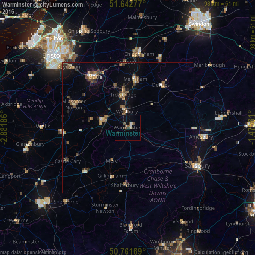
Analysis of Warminster night lights 2016
Square area 10x10 km:
 0.84%
0.84%90-99
1.4%80-89
0.56%70-79
0%60-69
0.7%50-59
1.12%40-49
3.08%30-39
2.38%20-29
0.7%10-19
0.98%0-9
88.24%Square area 50x50 km:
0.2%90-99
0.41%80-89
0.26%70-79
0.56%60-69
0.74%50-59
0.85%40-49
1.03%30-39
0.69%20-29
1.09%10-19
1.51%0-9
92.68%Clear (daylight) street map image can be seen on geolist.org.
Map coordinates:
51° 38' 34" North, 2° 52' 54.7" West
51° 12' 15.6" North, 2° 10' 43.4" West
50° 45' 42.1" North, 1° 28' 32.2" West
Some cities around Warminster sort by population:
• Trowbridge
12.9 km =8 mi,  350°
350°
• Frome
10.3 km =6.4 mi,  284°
284°
• Melksham
18.9 km =11.7 mi,  8°
8°
• Devizes
20.7 km =12.9 mi,  38°
38°
• Westbury
6.2 km =3.9 mi, 354°
• Bradford-on-Avon
16.7 km =10.4 mi,  342°
342°
• Gillingham
19.7 km =12.2 mi,  200°
200°
• Peasedown Saint John
21.2 km =13.2 mi,  306°
306°
2634755 (p: 17,490)
Sources (retrieved 2019-11-25):
» Earth at Night: Flat Maps 2012, 2016