Reading night lights from space
Night Light of Reading (England) from space (United Kingdom) Src. Average luminocity for 10x10km area is 57.6711% and for 50x50km: 19.946%.
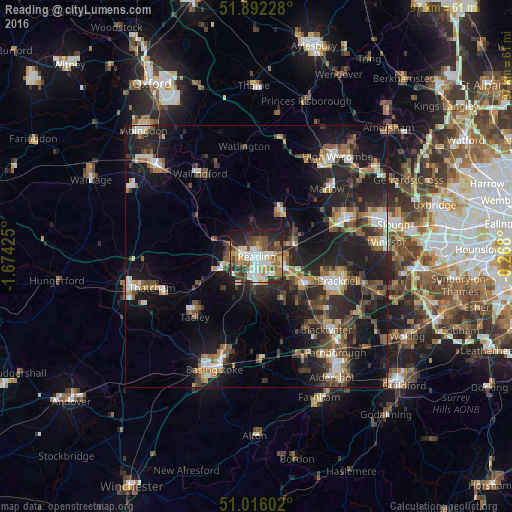
Analysis of Reading night lights 2016
Square area 10x10 km:
 12.03%
90-99
13.64%80-89
5.08%70-79
7.35%60-69
7.62%50-59
8.42%40-49
11.1%30-39
7.62%20-29
16.04%10-19
10.83%0-9
0.27%Square area 50x50 km:
2.23%90-99
2.95%80-89
1.45%70-79
2.07%60-69
2.92%50-59
2.97%40-49
3.98%30-39
3.41%20-29
8.42%10-19
17.28%0-9
52.3%Clear (daylight) street map image can be seen on geolist.org.
Map coordinates:
51° 53' 32.2" North, 1° 40' 27.3" West
51° 27' 22.5" North, 0° 58' 16.1" West
51° 0' 57.7" North, 0° 16' 4.8" West
Some cities around Reading sort by population:
• Bracknell
16 km =9.9 mi,  107°
107°
• Wokingham
10.6 km =6.6 mi,  118°
118°
• Lower Earley
4.8 km =3 mi,  132°
132°
• Crowthorne
15.7 km =9.8 mi, 127°
• Yateley
16 km =9.9 mi,  142°
142°
• Henley-on-Thames
9.9 km =6.2 mi,  29°
29°
• Calcot
5.8 km =3.6 mi,  252°
252°
• Twyford
8 km =5 mi,  74°
74°
2639577 (p: 318,014)
Sources (retrieved 2019-11-25):
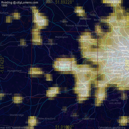
» NASA, Earths city lights 1995
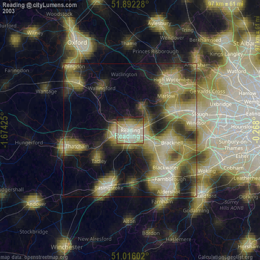
» NASA city lights 2003
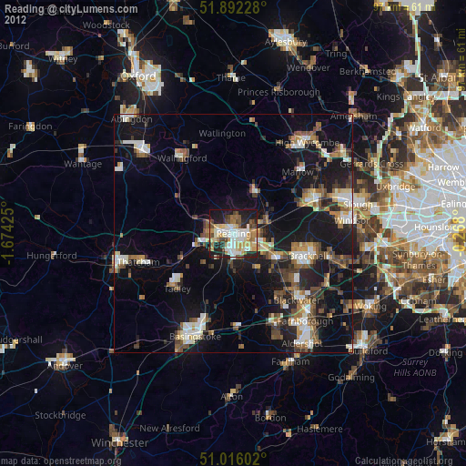
» Earth at Night: Flat Maps 2012, 2016