Telford night lights from space
Night Light of Telford (England) from space (United Kingdom) Src. Average luminocity for 10x10km area is 56.8929% and for 50x50km: 12.5257%.
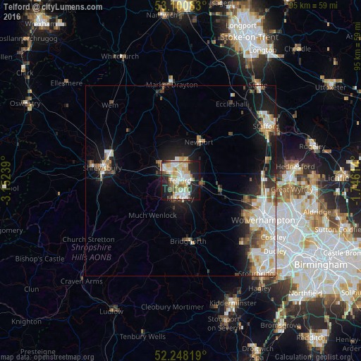

Analysis of Telford night lights 2016
Square area 10x10 km:
 11.38%
90-99
17.99%80-89
8.99%70-79
8.86%60-69
4.1%50-59
4.89%40-49
3.17%30-39
2.78%20-29
14.15%10-19
20.24%0-9
3.44%Square area 50x50 km:
2.72%90-99
2.89%80-89
1.27%70-79
1.55%60-69
1.25%50-59
1.22%40-49
1.36%30-39
1.3%20-29
2.47%10-19
7.23%0-9
76.74%Clear (daylight) street map image can be seen on geolist.org.
Map coordinates:
53° 6' 3" North, 3° 9' 8.6" West
52° 40' 35.7" North, 2° 26' 57.3" West
52° 14' 53.5" North, 1° 44' 46.1" West
Some cities around Telford sort by population:
• Wellington
5.2 km =3.2 mi,  299°
299°
• Ryton
9.4 km =5.8 mi,  134°
134°
• Hadley
3.5 km =2.2 mi,  318°
318°
• Newport
11.1 km =6.9 mi,  25°
25°
• Bridgnorth
15.7 km =9.8 mi,  172°
172°
• Oakengates
2 km =1.2 mi,  357°
357°
• Shifnal
5.2 km =3.2 mi,  97°
97°
• Broseley
7.4 km =4.6 mi,  197°
197°
3345439 (p: 147,980)
Sources (retrieved 2019-11-25):
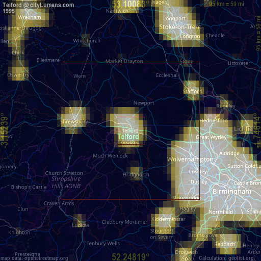
» NASA, Earths city lights 1995
» NASA city lights 2003
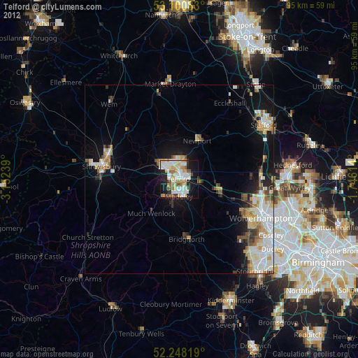
» Earth at Night: Flat Maps 2012, 2016