Tadcaster night lights from space
Night Light of Tadcaster (England) from space (United Kingdom) Src. Average luminocity for 10x10km area is 6.6548% and for 50x50km: 22.759%.
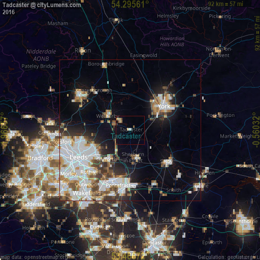
Analysis of Tadcaster night lights 2016
Square area 10x10 km:
 0.53%
0.53%90-99
0.93%80-89
1.98%70-79
0.26%60-69
0.66%50-59
1.46%40-49
0%30-39
0.13%20-29
0.4%10-19
0.66%0-9
92.99%Square area 50x50 km:
6.56%90-99
5.6%80-89
1.53%70-79
2.05%60-69
2.33%50-59
2.22%40-49
2.39%30-39
2.83%20-29
3.29%10-19
7.53%0-9
63.66%Clear (daylight) street map image can be seen on geolist.org.
Map coordinates:
54° 17' 44.2" North, 1° 57' 59.7" West
53° 52' 59.6" North, 1° 15' 48.4" West
53° 28' 0.2" North, 0° 33' 37.2" West
Some cities around Tadcaster sort by population:
• York
14.4 km =8.9 mi,  55°
55°
• Castleford
18.7 km =11.6 mi,  200°
200°
• Selby
17 km =10.6 mi,  130°
130°
• Kippax
14.7 km =9.1 mi,  208°
208°
• Garforth
12.8 km =8 mi,  217°
217°
• Wetherby
9.5 km =5.9 mi,  301°
301°
• Sherburn in Elmet
9.9 km =6.2 mi,  173°
173°
• Boston Spa
5.8 km =3.6 mi,  293°
293°
2636335 (p: 6,480)
Sources (retrieved 2019-11-25):
» Earth at Night: Flat Maps 2012, 2016