Sunderland night lights from space
Night Light of Sunderland (England) from space (United Kingdom) Src. Average luminocity for 10x10km area is 65.5813% and for 50x50km: 24.3998%.
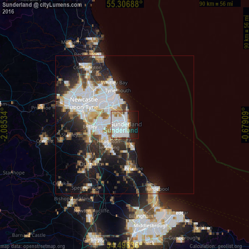
Analysis of Sunderland night lights 2016
Square area 10x10 km:
 33.97%
90-99
15.07%80-89
3.35%70-79
5.02%60-69
4.55%50-59
2.99%40-49
1.08%30-39
1.67%20-29
9.57%10-19
11.6%0-9
11.12%Square area 50x50 km:
7.42%90-99
5.29%80-89
1.97%70-79
1.94%60-69
2.28%50-59
2.27%40-49
2.2%30-39
4.12%20-29
6.19%10-19
10.04%0-9
56.29%Clear (daylight) street map image can be seen on geolist.org.
Map coordinates:
55° 18' 24.8" North, 2° 5' 7.2" West
54° 54' 16.7" North, 1° 22' 56" West
54° 29' 54.1" North, 0° 40' 44.7" West
Some cities around Sunderland sort by population:
• Washington
8.6 km =5.3 mi,  266°
266°
• Houghton-Le-Spring
8.9 km =5.5 mi,  216°
216°
• Seaham
7.7 km =4.8 mi,  162°
162°
• Ryhope
3.8 km =2.4 mi,  168°
168°
• The Boldons
6.2 km =3.9 mi,  312°
312°
• Murton
9.6 km =6 mi,  183°
183°
• Whitburn
5.5 km =3.4 mi,  9°
9°
• East Boldon
5.3 km =3.3 mi,  326°
326°
2636531 (p: 335,415)
Sources (retrieved 2019-11-25):
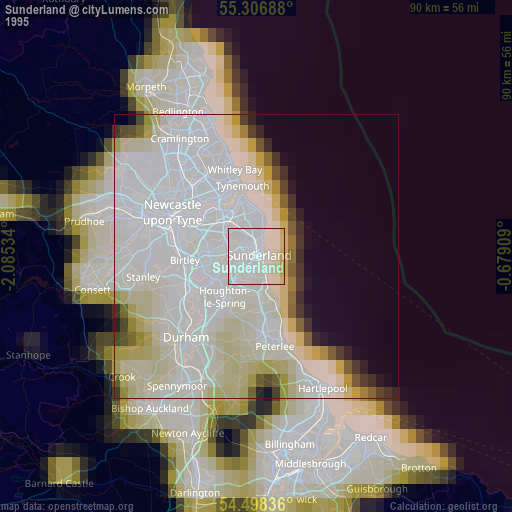
» NASA, Earths city lights 1995
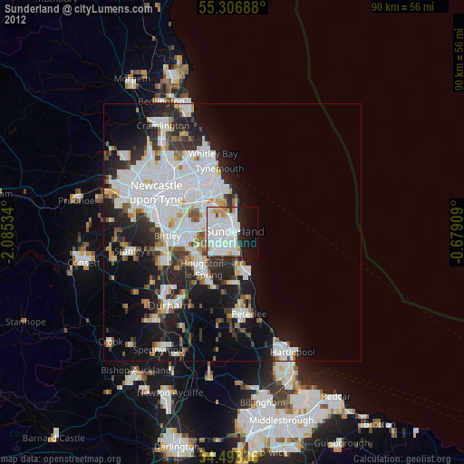
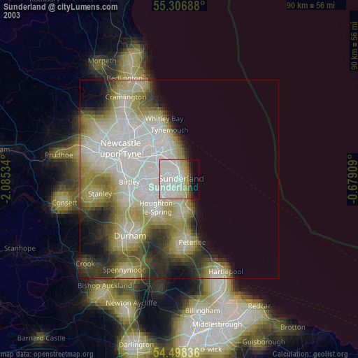
» NASA city lights 2003
» Earth at Night: Flat Maps 2012, 2016