The Boldons night lights from space
Night Light of The Boldons (England) from space (United Kingdom) Src. Average luminocity for 10x10km area is 89.512% and for 50x50km: 24.2061%.
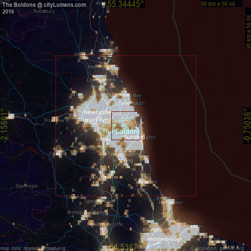
Analysis of The Boldons night lights 2016
Square area 10x10 km:
 44.14%
90-99
25.72%80-89
8.13%70-79
6.46%60-69
5.86%50-59
5.62%40-49
1.56%30-39
1.79%20-29
0.72%10-19
0%0-9
0%Square area 50x50 km:
7.36%90-99
5.25%80-89
2%70-79
1.96%60-69
2.16%50-59
2.22%40-49
2.16%30-39
3.89%20-29
6.44%10-19
9.54%0-9
57.03%Clear (daylight) street map image can be seen on geolist.org.
Map coordinates:
55° 20' 40" North, 2° 9' 23.8" West
54° 56' 33.4" North, 1° 27' 12.6" West
54° 32' 12.1" North, 0° 45' 1.3" West
Some cities around The Boldons sort by population:
• Sunderland
6.2 km =3.9 mi,  132°
132°
• South Shields
6.4 km =4 mi,  12°
12°
• Washington
6.2 km =3.9 mi,  220°
220°
• Wallsend
7.4 km =4.6 mi,  316°
316°
• Jarrow
4.6 km =2.9 mi,  334°
334°
• Hebburn
5.2 km =3.2 mi,  310°
310°
• Whitburn
5.6 km =3.5 mi,  77°
77°
• East Boldon
1.6 km =1 mi, 82°
2655250 (p: 13,567)
Sources (retrieved 2019-11-25):
» Earth at Night: Flat Maps 2012, 2016