Stockton-on-Tees night lights from space
Night Light of Stockton-on-Tees (England) from space (United Kingdom) Src. Average luminocity for 10x10km area is 73.9306% and for 50x50km: 18.0983%.
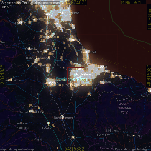
Analysis of Stockton-on-Tees night lights 2016
Square area 10x10 km:
 25.24%
90-99
27.63%80-89
6.58%70-79
5.86%60-69
4.19%50-59
5.26%40-49
2.99%30-39
4.9%20-29
6.7%10-19
10.05%0-9
0.6%Square area 50x50 km:
3.42%90-99
4.01%80-89
1.56%70-79
1.66%60-69
2.17%50-59
1.91%40-49
1.85%30-39
2.69%20-29
4.73%10-19
13.53%0-9
62.48%Clear (daylight) street map image can be seen on geolist.org.
Map coordinates:
54° 58' 26.7" North, 2° 1' 18.6" West
54° 34' 6.5" North, 1° 19' 7.3" West
54° 9' 31.8" North, 0° 36' 56.1" West
Some cities around Stockton-on-Tees sort by population:
• Middlesbrough
5.5 km =3.4 mi,  80°
80°
• Darlington
15.7 km =9.8 mi,  251°
251°
• Hartlepool
14.8 km =9.2 mi,  28°
28°
• Billingham
2.9 km =1.8 mi,  38°
38°
• Newton Aycliffe
17.2 km =10.7 mi,  288°
288°
• Thornaby-on-Tees
4.1 km =2.5 mi,  162°
162°
• Yarm
7.6 km =4.7 mi,  199°
199°
• Eaglescliffe
5.2 km =3.2 mi, 203°
2636876 (p: 79,957)
Sources (retrieved 2019-11-25):
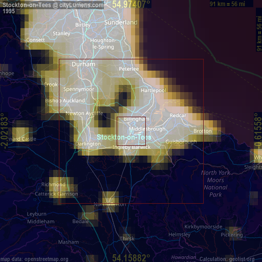
» NASA, Earths city lights 1995
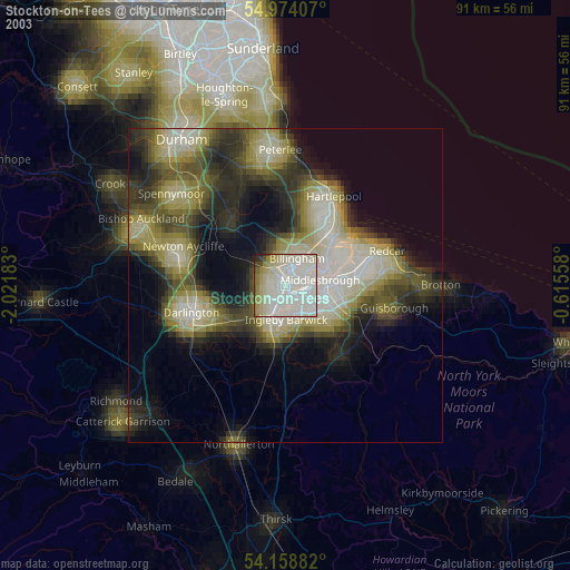
» NASA city lights 2003
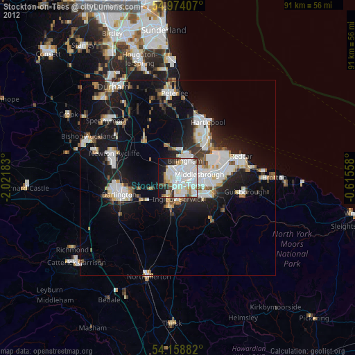
» Earth at Night: Flat Maps 2012, 2016