Thornaby-on-Tees night lights from space
Night Light of Thornaby-on-Tees (England) from space (United Kingdom) Src. Average luminocity for 10x10km area is 65.6041% and for 50x50km: 16.7651%.
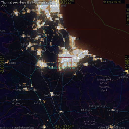
Analysis of Thornaby-on-Tees night lights 2016
Square area 10x10 km:
 18.9%
18.9%90-99
19.5%80-89
5.86%70-79
7.66%60-69
6.34%50-59
7.66%40-49
3.35%30-39
7.18%20-29
14.59%10-19
8.61%0-9
0.36%Square area 50x50 km:
3.28%90-99
3.82%80-89
1.47%70-79
1.51%60-69
1.94%50-59
1.7%40-49
1.61%30-39
2.44%20-29
4.33%10-19
12.04%0-9
65.87%Clear (daylight) street map image can be seen on geolist.org.
Map coordinates:
54° 56' 21.4" North, 2° 0' 11.3" West
54° 31' 60" North, 1° 18' 0" West
54° 7' 23.9" North, 0° 35' 48.8" West
Some cities around Thornaby-on-Tees sort by population:
• Middlesbrough
6.4 km =4 mi,  41°
41°
• Darlington
16.2 km =10.1 mi,  266°
266°
• Stockton-on-Tees
4.1 km =2.5 mi,  342°
342°
• Billingham
6.2 km =3.9 mi,  5°
5°
• Yarm
5 km =3.1 mi,  228°
228°
• Guisborough
15.7 km =9.8 mi,  89°
89°
• Ingleby Greenhow
15.5 km =9.6 mi,  126°
126°
• Eaglescliffe
3.4 km =2.1 mi,  254°
254°
2636005 (p: 22,356)
Sources (retrieved 2019-11-25):
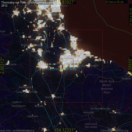
» Earth at Night: Flat Maps 2012, 2016