Middlesbrough night lights from space
Night Light of Middlesbrough (England) from space (United Kingdom) Src. Average luminocity for 10x10km area is 91.0335% and for 50x50km: 17.4788%.
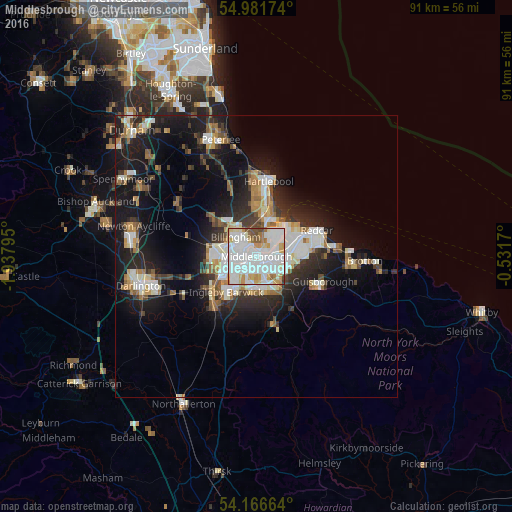
Analysis of Middlesbrough night lights 2016
Square area 10x10 km:
 37.08%
90-99
35.17%80-89
9.81%70-79
7.42%60-69
4.07%50-59
2.27%40-49
3.71%30-39
0.48%20-29
0%10-19
0%0-9
0%Square area 50x50 km:
3.43%90-99
3.93%80-89
1.52%70-79
1.6%60-69
2.05%50-59
1.71%40-49
1.75%30-39
2.58%20-29
4.86%10-19
12.65%0-9
63.92%Clear (daylight) street map image can be seen on geolist.org.
Map coordinates:
54° 58' 54.3" North, 1° 56' 16.6" West
54° 34' 34.4" North, 1° 14' 5.4" West
54° 9' 59.9" North, 0° 31' 54.1" West
Some cities around Middlesbrough sort by population:
• Hartlepool
12.3 km =7.6 mi,  7°
7°
• Stockton-on-Tees
5.5 km =3.4 mi,  260°
260°
• Redcar
12.1 km =7.5 mi,  68°
68°
• Billingham
3.8 km =2.4 mi,  291°
291°
• Thornaby-on-Tees
6.4 km =4 mi,  221°
221°
• Yarm
11.3 km =7 mi, 224°
• Guisborough
12.4 km =7.7 mi,  111°
111°
• Eaglescliffe
9.4 km =5.8 mi,  232°
232°
2642607 (p: 142,707)
Sources (retrieved 2019-11-25):
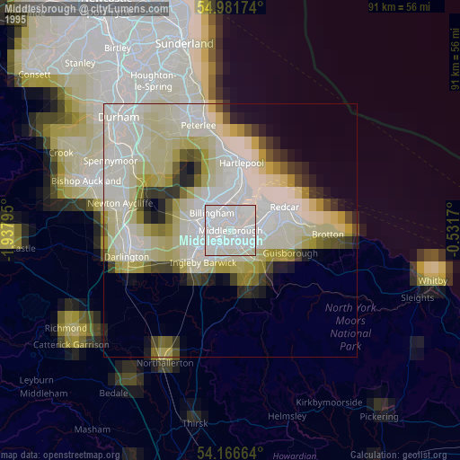
» NASA, Earths city lights 1995
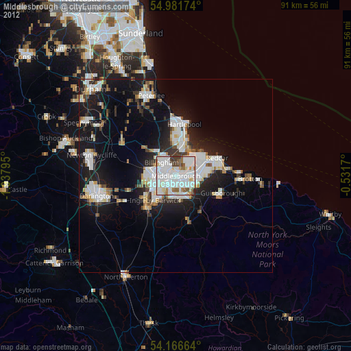
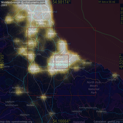
» NASA city lights 2003
» Earth at Night: Flat Maps 2012, 2016