Darlington night lights from space
Night Light of Darlington (England) from space (United Kingdom) Src. Average luminocity for 10x10km area is 31.1268% and for 50x50km: 13.6716%.
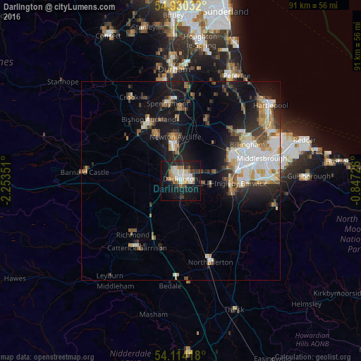
Analysis of Darlington night lights 2016
Square area 10x10 km:
 3.59%
3.59%90-99
8.25%80-89
3.95%70-79
1.91%60-69
5.62%50-59
1.56%40-49
2.99%30-39
3.47%20-29
8.13%10-19
32.3%0-9
28.23%Square area 50x50 km:
2.53%90-99
2.95%80-89
1.18%70-79
1.33%60-69
1.78%50-59
1.65%40-49
1.42%30-39
2.06%20-29
3.01%10-19
9.5%0-9
72.57%Clear (daylight) street map image can be seen on geolist.org.
Map coordinates:
54° 55' 49.2" North, 2° 15' 12.6" West
54° 31' 27.4" North, 1° 33' 1.4" West
54° 6' 51" North, 0° 50' 50.1" West
Some cities around Darlington sort by population:
• Stockton-on-Tees
15.7 km =9.8 mi,  71°
71°
• Bishop Auckland
16.7 km =10.4 mi,  330°
330°
• Newton Aycliffe
10.6 km =6.6 mi,  352°
352°
• Thornaby-on-Tees
16.2 km =10.1 mi,  86°
86°
• Yarm
12.6 km =7.8 mi,  100°
100°
• Shildon
13.2 km =8.2 mi, 333°
• Ferryhill
17.7 km =11 mi,  0°
0°
• Eaglescliffe
12.9 km =8 mi, 89°
2651513 (p: 92,363)
Sources (retrieved 2019-11-25):
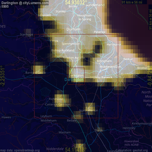
» NASA, Earths city lights 1995
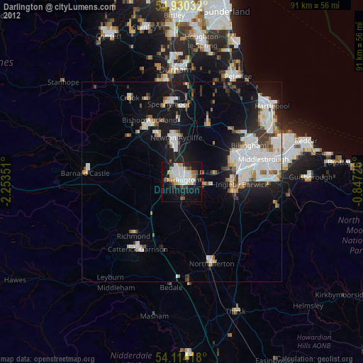
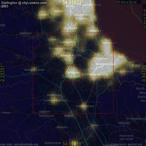
» NASA city lights 2003
» Earth at Night: Flat Maps 2012, 2016