Billingham night lights from space
Night Light of Billingham (England) from space (United Kingdom) Src. Average luminocity for 10x10km area is 79.2141% and for 50x50km: 18.4829%.
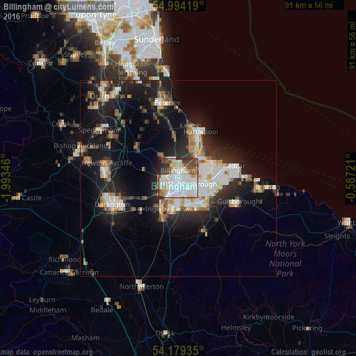
Analysis of Billingham night lights 2016
Square area 10x10 km:
 26.79%
90-99
28.35%80-89
9.09%70-79
5.14%60-69
4.43%50-59
5.74%40-49
7.3%30-39
7.89%20-29
3.83%10-19
1.44%0-9
0%Square area 50x50 km:
3.47%90-99
3.95%80-89
1.52%70-79
1.73%60-69
2.27%50-59
1.98%40-49
1.93%30-39
2.78%20-29
5.4%10-19
13.95%0-9
61.02%Clear (daylight) street map image can be seen on geolist.org.
Map coordinates:
54° 59' 39.1" North, 1° 59' 36.5" West
54° 35' 19.7" North, 1° 17' 25.2" West
54° 10' 45.7" North, 0° 35' 14" West
Some cities around Billingham sort by population:
• Middlesbrough
3.8 km =2.4 mi,  111°
111°
• Hartlepool
11.9 km =7.4 mi,  25°
25°
• Stockton-on-Tees
2.9 km =1.8 mi,  218°
218°
• Redcar
15.2 km =9.4 mi,  78°
78°
• Thornaby-on-Tees
6.2 km =3.9 mi,  185°
185°
• Yarm
10.4 km =6.5 mi,  204°
204°
• Guisborough
16.3 km =10.1 mi, 111°
• Eaglescliffe
8.1 km =5 mi,  208°
208°
2655664 (p: 35,708)
Sources (retrieved 2019-11-25):
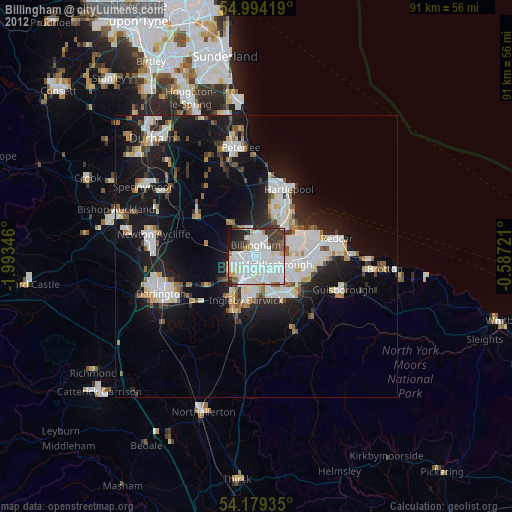
» Earth at Night: Flat Maps 2012, 2016