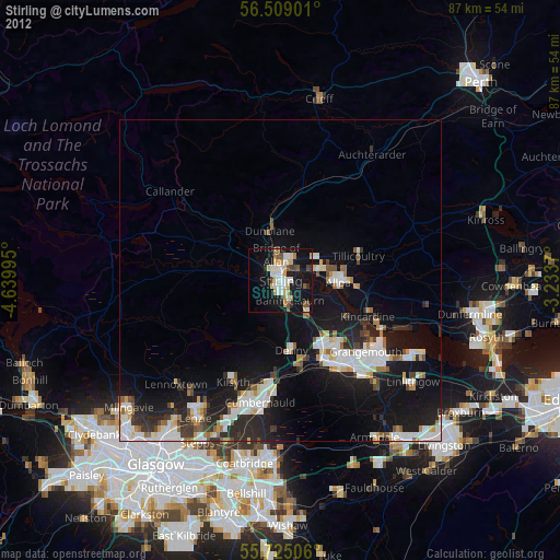
Stirling night lights from space
Night Light of Stirling (Scotland) from space (United Kingdom) Src. Average luminocity for 10x10km area is 26.9725% and for 50x50km: 12.8199%.
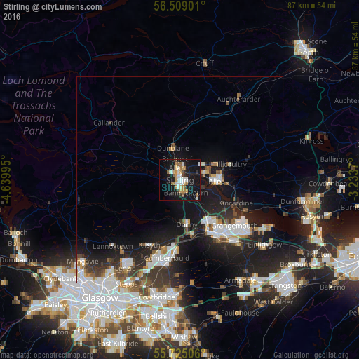
Analysis of Stirling night lights 2016
Square area 10x10 km:
 3.83%
3.83%90-99
5.26%80-89
1.67%70-79
5.38%60-69
3.23%50-59
2.99%40-49
1.08%30-39
2.39%20-29
1.56%10-19
41.87%0-9
30.74%Square area 50x50 km:
2.42%90-99
2.69%80-89
0.75%70-79
1.15%60-69
1.26%50-59
1.07%40-49
1.36%30-39
2.32%20-29
4.72%10-19
12.46%0-9
69.77%Clear (daylight) street map image can be seen on geolist.org.
Map coordinates:
56° 30' 32.4" North, 4° 38' 23.8" West
56° 7' 8.5" North, 3° 56' 12.6" West
55° 43' 30.2" North, 3° 14' 1.3" West
Some cities around Stirling sort by population:
• Alloa
9.1 km =5.7 mi,  92°
92°
• Stenhousemuir
12.8 km =8 mi,  143°
143°
• Larbert
12.7 km =7.9 mi,  148°
148°
• Dunblane
7.9 km =4.9 mi,  347°
347°
• Tullibody
6.3 km =3.9 mi,  75°
75°
• Denny
10.8 km =6.7 mi,  170°
170°
• Bannockburn
3.6 km =2.2 mi, 153°
• Tillicoultry
12.7 km =7.9 mi,  73°
73°
2636910 (p: 36,440)
Sources (retrieved 2019-11-25):
» Earth at Night: Flat Maps 2012, 2016