Dunblane night lights from space
Night Light of Dunblane (Scotland) from space (United Kingdom) Src. Average luminocity for 10x10km area is 7.4904% and for 50x50km: 7.2457%.
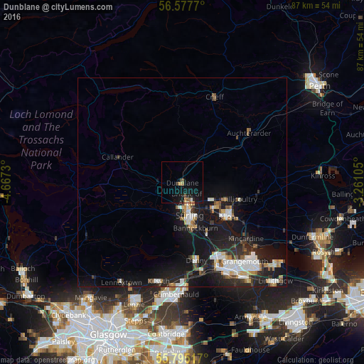
Analysis of Dunblane night lights 2016
Square area 10x10 km:
 0%
0%90-99
0.72%80-89
0.48%70-79
1.32%60-69
1.44%50-59
1.08%40-49
0.72%30-39
0.24%20-29
1.44%10-19
13.4%0-9
79.19%Square area 50x50 km:
1.16%90-99
1.46%80-89
0.48%70-79
0.67%60-69
0.77%50-59
0.69%40-49
0.66%30-39
0.89%20-29
2.42%10-19
8.72%0-9
82.06%Clear (daylight) street map image can be seen on geolist.org.
Map coordinates:
56° 34' 39.7" North, 4° 40' 2.3" West
56° 11' 18.3" North, 3° 57' 51" West
55° 47' 42.6" North, 3° 15' 39.8" West
Some cities around Dunblane sort by population:
• Stirling
7.9 km =4.9 mi,  167°
167°
• Alloa
13.5 km =8.4 mi,  126°
126°
• Stenhousemuir
20.2 km =12.6 mi,  152°
152°
• Larbert
20.3 km =12.6 mi,  155°
155°
• Tullibody
9.9 km =6.2 mi, 128°
• Denny
18.7 km =11.6 mi, 169°
• Bannockburn
11.5 km =7.1 mi, 163°
• Tillicoultry
14.4 km =8.9 mi,  106°
106°
2650769 (p: 8,830)
Sources (retrieved 2019-11-25):
» Earth at Night: Flat Maps 2012, 2016