Alloa night lights from space
Night Light of Alloa (Scotland) from space (United Kingdom) Src. Average luminocity for 10x10km area is 24.5921% and for 50x50km: 14.8591%.
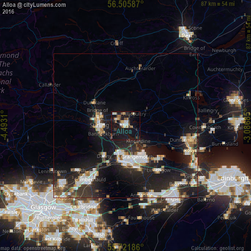

Analysis of Alloa night lights 2016
Square area 10x10 km:
 2.63%
2.63%90-99
4.67%80-89
1.79%70-79
2.39%60-69
3.59%50-59
2.75%40-49
2.99%30-39
1.67%20-29
3.47%10-19
47.73%0-9
26.32%Square area 50x50 km:
2.64%90-99
2.95%80-89
1.12%70-79
1.5%60-69
1.57%50-59
1.42%40-49
1.42%30-39
2.33%20-29
5.93%10-19
14.03%0-9
65.09%Clear (daylight) street map image can be seen on geolist.org.
Map coordinates:
56° 30' 21.1" North, 4° 29' 35.2" West
56° 6' 57.1" North, 3° 47' 23.9" West
55° 43' 18.7" North, 3° 5' 12.7" West
Some cities around Alloa sort by population:
• Stirling
9.1 km =5.7 mi,  272°
272°
• Grangemouth
12.4 km =7.7 mi,  159°
159°
• Stenhousemuir
10 km =6.2 mi,  188°
188°
• Larbert
10.7 km =6.6 mi, 193°
• Tullibody
3.6 km =2.2 mi,  303°
303°
• Denny
12.6 km =7.8 mi,  215°
215°
• Bannockburn
8 km =5 mi,  248°
248°
• Tillicoultry
5.1 km =3.2 mi,  37°
37°
2657471 (p: 20,390)
Sources (retrieved 2019-11-25):
» Earth at Night: Flat Maps 2012, 2016