Stenhousemuir night lights from space
Night Light of Stenhousemuir (Scotland) from space (United Kingdom) Src. Average luminocity for 10x10km area is 44.7018% and for 50x50km: 22.5986%.
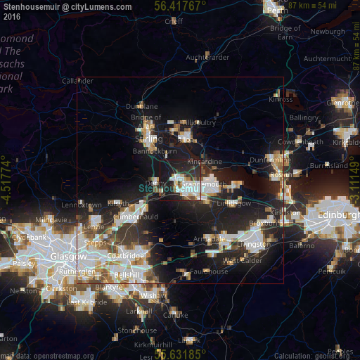
Analysis of Stenhousemuir night lights 2016
Square area 10x10 km:
 10.65%
90-99
12.53%80-89
3.88%70-79
2.01%60-69
4.01%50-59
3.38%40-49
3.13%30-39
5.39%20-29
19.05%10-19
32.58%0-9
3.38%Square area 50x50 km:
4.92%90-99
5.26%80-89
1.67%70-79
2.36%60-69
2.23%50-59
2.11%40-49
2.25%30-39
2.86%20-29
6.99%10-19
16.01%0-9
53.34%Clear (daylight) street map image can be seen on geolist.org.
Map coordinates:
56° 25' 3.6" North, 4° 31' 3.9" West
56° 1' 36.3" North, 3° 48' 52.6" West
55° 37' 54.7" North, 3° 6' 41.4" West
Some cities around Stenhousemuir sort by population:
• Falkirk
3.3 km =2.1 mi,  146°
146°
• Alloa
10 km =6.2 mi,  8°
8°
• Grangemouth
6 km =3.7 mi,  106°
106°
• Larbert
1 km =0.6 mi,  241°
241°
• Denny
5.8 km =3.6 mi,  266°
266°
• Bannockburn
9.2 km =5.7 mi,  319°
319°
• Polmont
7.8 km =4.8 mi,  121°
121°
• Bonnybridge
5.4 km =3.4 mi, 238°
11592294 (p: 10,050)
Sources (retrieved 2019-11-25):
» Earth at Night: Flat Maps 2012, 2016