Staines night lights from space
Night Light of Staines (England) from space (United Kingdom) Src. Average luminocity for 10x10km area is 63.7767% and for 50x50km: 51.1668%.
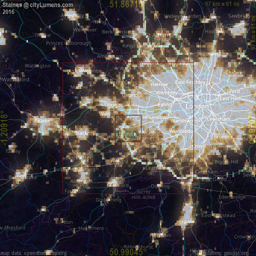
Analysis of Staines night lights 2016
Square area 10x10 km:
 10.96%
90-99
11.9%80-89
5.35%70-79
8.56%60-69
11.23%50-59
16.18%40-49
23.53%30-39
9.36%20-29
2.94%10-19
0%0-9
0%Square area 50x50 km:
14.19%90-99
11.33%80-89
4.39%70-79
4.85%60-69
6.25%50-59
6.99%40-49
7.35%30-39
6.5%20-29
10.22%10-19
16.14%0-9
11.79%Clear (daylight) street map image can be seen on geolist.org.
Map coordinates:
51° 52' 1.9" North, 1° 12' 33" West
51° 25' 51.3" North, 0° 30' 21.8" West
50° 59' 25.6" North, 0° 11' 49.5" East
Some cities around Staines sort by population:
• Egham
3.2 km =2 mi,  271°
271°
• Ashford
3.4 km =2.1 mi,  88°
88°
• Feltham
6.6 km =4.1 mi,  75°
75°
• Addlestone
6.7 km =4.2 mi,  172°
172°
• Chertsey
4.8 km =3 mi,  181°
181°
• Shepperton
5.6 km =3.5 mi,  134°
134°
• Old Windsor
6.4 km =4 mi,  298°
298°
• Colnbrook
6 km =3.7 mi,  349°
349°
2637126 (p: 51,040)
Sources (retrieved 2019-11-25):
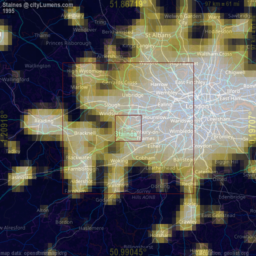
» NASA, Earths city lights 1995
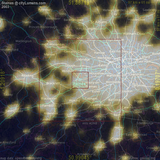
» NASA city lights 2003
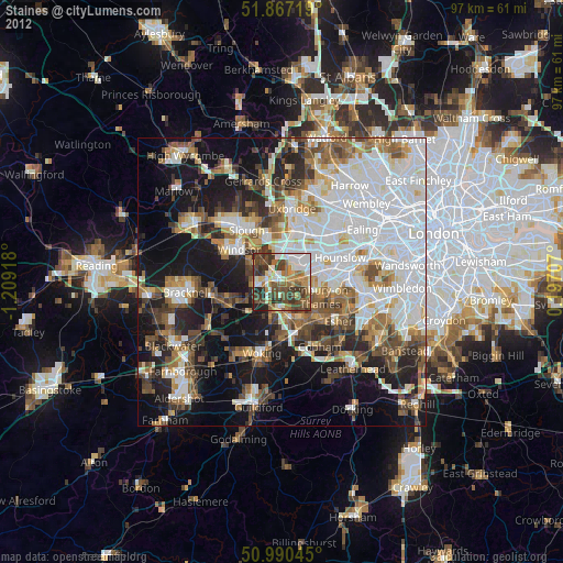
» Earth at Night: Flat Maps 2012, 2016