Shepperton night lights from space
Night Light of Shepperton (England) from space (United Kingdom) Src. Average luminocity for 10x10km area is 60.6891% and for 50x50km: 52.2331%.
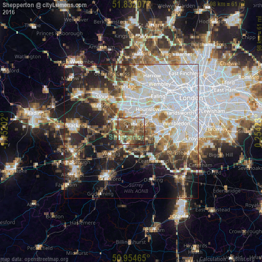
Analysis of Shepperton night lights 2016
Square area 10x10 km:
 5.6%
5.6%90-99
7.56%80-89
5.6%70-79
8.82%60-69
15.55%50-59
23.25%40-49
23.67%30-39
6.58%20-29
3.36%10-19
0%0-9
0%Square area 50x50 km:
17.77%90-99
11.27%80-89
4.09%70-79
4.42%60-69
5.32%50-59
6.01%40-49
6.91%30-39
6.26%20-29
9.72%10-19
13.77%0-9
14.47%Clear (daylight) street map image can be seen on geolist.org.
Map coordinates:
51° 49' 55.5" North, 1° 9' 7.3" West
51° 23' 43.7" North, 0° 26' 56" West
50° 57' 16.7" North, 0° 15' 15.2" East
Some cities around Shepperton sort by population:
• Staines
5.6 km =3.5 mi,  314°
314°
• Sunbury-on-Thames
2.3 km =1.4 mi,  65°
65°
• Ashford
4.1 km =2.5 mi,  351°
351°
• Walton-on-Thames
2.7 km =1.7 mi,  111°
111°
• Weybridge
2.7 km =1.7 mi,  195°
195°
• West Molesey
4.8 km =3 mi,  84°
84°
• Addlestone
4.1 km =2.5 mi,  229°
229°
• Chertsey
4.2 km =2.6 mi,  258°
258°
2638039 (p: 10,106)
Sources (retrieved 2019-11-25):
» Earth at Night: Flat Maps 2012, 2016