Chertsey night lights from space
Night Light of Chertsey (England) from space (United Kingdom) Src. Average luminocity for 10x10km area is 53.4146% and for 50x50km: 46.5198%.
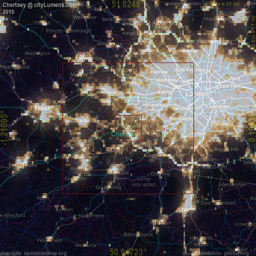
Analysis of Chertsey night lights 2016
Square area 10x10 km:
 3.64%
3.64%90-99
5.6%80-89
5.32%70-79
8.26%60-69
11.48%50-59
17.79%40-49
21.29%30-39
10.22%20-29
13.45%10-19
2.94%0-9
0%Square area 50x50 km:
13.1%90-99
10.34%80-89
3.84%70-79
4.23%60-69
5.15%50-59
5.9%40-49
6.94%30-39
6.41%20-29
9.97%10-19
14.67%0-9
19.45%Clear (daylight) street map image can be seen on geolist.org.
Map coordinates:
51° 49' 29.3" North, 1° 12' 39.4" West
51° 23' 17.2" North, 0° 30' 28.2" West
50° 56' 50" North, 0° 11' 43.1" East
Some cities around Chertsey sort by population:
• Staines
4.8 km =3 mi,  1°
1°
• Egham
5.7 km =3.5 mi,  327°
327°
• Sunbury-on-Thames
6.5 km =4 mi,  73°
73°
• Ashford
6 km =3.7 mi,  35°
35°
• Weybridge
3.8 km =2.4 mi,  118°
118°
• Addlestone
2.1 km =1.3 mi,  151°
151°
• Shepperton
4.2 km =2.6 mi,  78°
78°
• West Byfleet
5.6 km =3.5 mi,  179°
179°
2653239 (p: 10,553)
Sources (retrieved 2019-11-25):
» Earth at Night: Flat Maps 2012, 2016