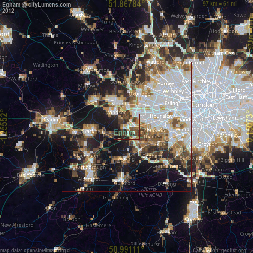
Egham night lights from space
Night Light of Egham (England) from space (United Kingdom) Src. Average luminocity for 10x10km area is 52.7714% and for 50x50km: 47.0481%.
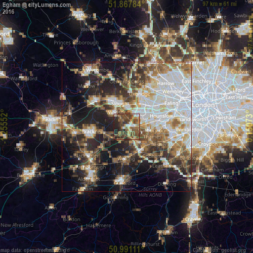
Analysis of Egham night lights 2016
Square area 10x10 km:
 4.55%
4.55%90-99
6.28%80-89
3.88%70-79
7.75%60-69
9.89%50-59
16.44%40-49
21.66%30-39
12.03%20-29
13.37%10-19
4.14%0-9
0%Square area 50x50 km:
11.58%90-99
10.12%80-89
4.09%70-79
4.67%60-69
6.2%50-59
6.94%40-49
7.29%30-39
6.38%20-29
10.34%10-19
16.74%0-9
15.65%Clear (daylight) street map image can be seen on geolist.org.
Map coordinates:
51° 52' 4.2" North, 1° 15' 19.9" West
51° 25' 53.7" North, 0° 33' 8.6" West
50° 59' 28" North, 0° 9' 2.6" East
Some cities around Egham sort by population:
• Staines
3.2 km =2 mi,  91°
91°
• Windsor
6.6 km =4.1 mi,  330°
330°
• Ashford
6.6 km =4.1 mi, 89°
• Addlestone
7.8 km =4.8 mi,  148°
148°
• Chertsey
5.7 km =3.5 mi, 147°
• Shepperton
8.2 km =5.1 mi,  119°
119°
• Old Windsor
3.8 km =2.4 mi,  321°
321°
• Colnbrook
6.2 km =3.9 mi,  20°
20°
2650188 (p: 29,663)
Sources (retrieved 2019-11-25):
» Earth at Night: Flat Maps 2012, 2016