Shepshed night lights from space
Night Light of Shepshed (England) from space (United Kingdom) Src. Average luminocity for 10x10km area is 29.2412% and for 50x50km: 28.0754%.
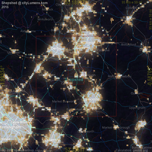
Analysis of Shepshed night lights 2016
Square area 10x10 km:
 4.17%
4.17%90-99
3.16%80-89
1.77%70-79
2.27%60-69
3.91%50-59
4.67%40-49
2.9%30-39
2.78%20-29
8.59%10-19
65.78%0-9
0%Square area 50x50 km:
5.13%90-99
5.75%80-89
2.98%70-79
3.01%60-69
3.17%50-59
2.94%40-49
3.53%30-39
3.55%20-29
9.01%10-19
20.45%0-9
40.47%Clear (daylight) street map image can be seen on geolist.org.
Map coordinates:
53° 11' 20.7" North, 1° 59' 36" West
52° 45' 56.5" North, 1° 17' 24.8" West
52° 20' 17.4" North, 0° 35' 13.5" West
Some cities around Shepshed sort by population:
• Loughborough
6.1 km =3.8 mi,  88°
88°
• Coalville
7.2 km =4.5 mi,  228°
228°
• Mountsorrel
10.9 km =6.8 mi,  120°
120°
• Castle Donington
9.3 km =5.8 mi,  337°
337°
• East Leake
10.3 km =6.4 mi,  45°
45°
• Ibstock
11.6 km =7.2 mi,  219°
219°
• Barrow upon Soar
9.8 km =6.1 mi,  99°
99°
• Quorndon
8.2 km =5.1 mi,  106°
106°
2638036 (p: 13,505)
Sources (retrieved 2019-11-25):
» Earth at Night: Flat Maps 2012, 2016