Coalville night lights from space
Night Light of Coalville (England) from space (United Kingdom) Src. Average luminocity for 10x10km area is 28.4848% and for 50x50km: 28.3618%.
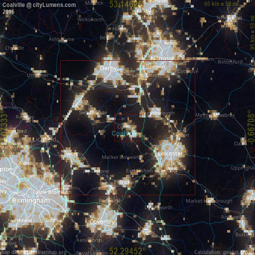
Analysis of Coalville night lights 2016
Square area 10x10 km:
 2.65%
2.65%90-99
4.42%80-89
2.02%70-79
3.03%60-69
4.55%50-59
7.2%40-49
3.16%30-39
2.9%20-29
5.68%10-19
39.39%0-9
25%Square area 50x50 km:
4.98%90-99
5.57%80-89
2.9%70-79
2.93%60-69
3.14%50-59
3.01%40-49
3.41%30-39
3.78%20-29
9.86%10-19
22.43%0-9
37.99%Clear (daylight) street map image can be seen on geolist.org.
Map coordinates:
53° 8' 46.5" North, 2° 4' 24" West
52° 43' 20.9" North, 1° 22' 12.7" West
52° 17' 40.3" North, 0° 40' 1.5" West
Some cities around Coalville sort by population:
• Loughborough
12.5 km =7.8 mi,  66°
66°
• Shepshed
7.2 km =4.5 mi,  48°
48°
• Ashby de la Zouch
7.4 km =4.6 mi,  290°
290°
• Anstey
13.4 km =8.3 mi,  113°
113°
• Castle Donington
13.5 km =8.4 mi,  8°
8°
• Ibstock
4.6 km =2.9 mi,  205°
205°
• Measham
9.3 km =5.8 mi,  259°
259°
• Quorndon
13.5 km =8.4 mi,  79°
79°
2652698 (p: 38,245)
Sources (retrieved 2019-11-25):
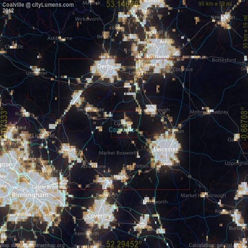
» Earth at Night: Flat Maps 2012, 2016