Loughborough night lights from space
Night Light of Loughborough (England) from space (United Kingdom) Src. Average luminocity for 10x10km area is 32.9773% and for 50x50km: 26.0189%.
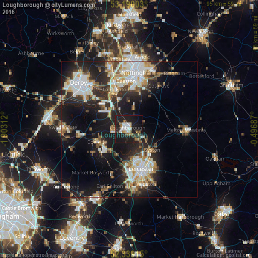
Analysis of Loughborough night lights 2016
Square area 10x10 km:
 6.57%
6.57%90-99
4.92%80-89
2.53%70-79
1.52%60-69
6.31%50-59
2.15%40-49
2.9%30-39
3.66%20-29
10.35%10-19
49.37%0-9
9.72%Square area 50x50 km:
4.88%90-99
5.41%80-89
2.89%70-79
2.59%60-69
2.98%50-59
2.86%40-49
3.31%30-39
3.32%20-29
7.96%10-19
17.61%0-9
46.19%Clear (daylight) street map image can be seen on geolist.org.
Map coordinates:
53° 11' 24.1" North, 1° 54' 11.2" West
52° 46' 0" North, 1° 12' 0" West
52° 20' 20.9" North, 0° 29' 48.7" West
Some cities around Loughborough sort by population:
• Coalville
12.5 km =7.8 mi,  246°
246°
• Mountsorrel
6.5 km =4 mi,  148°
148°
• Shepshed
6.1 km =3.8 mi,  268°
268°
• Sileby
7.3 km =4.5 mi,  121°
121°
• Anstey
10.4 km =6.5 mi,  175°
175°
• East Leake
7.2 km =4.5 mi,  10°
10°
• Barrow upon Soar
4 km =2.5 mi,  114°
114°
• Quorndon
3 km =1.9 mi,  143°
143°
2643567 (p: 59,932)
Sources (retrieved 2019-11-25):
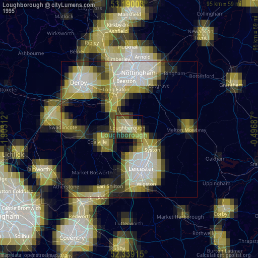
» NASA, Earths city lights 1995
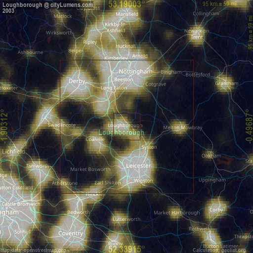
» NASA city lights 2003
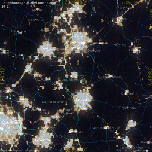
» Earth at Night: Flat Maps 2012, 2016