Shaftesbury night lights from space
Night Light of Shaftesbury (England) from space (United Kingdom) Src. Average luminocity for 10x10km area is 3.5976% and for 50x50km: 2.5714%.
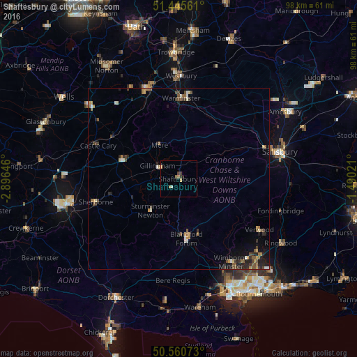
Analysis of Shaftesbury night lights 2016
Square area 10x10 km:
 0%
0%90-99
0.53%80-89
0%70-79
1.6%60-69
0.67%50-59
0.4%40-49
0.27%30-39
1.34%20-29
0.53%10-19
0%0-9
94.65%Square area 50x50 km:
0.12%90-99
0.33%80-89
0.13%70-79
0.45%60-69
0.42%50-59
0.47%40-49
0.5%30-39
0.4%20-29
0.91%10-19
1.04%0-9
95.23%Clear (daylight) street map image can be seen on geolist.org.
Map coordinates:
51° 26' 44.2" North, 2° 53' 47.3" West
51° 0' 19" North, 2° 11' 36" West
50° 33' 38.6" North, 1° 29' 24.8" West
Some cities around Shaftesbury sort by population:
• Frome
26.4 km =16.4 mi,  340°
340°
• Warminster
22.2 km =13.8 mi,  2°
2°
• Verwood
26.8 km =16.7 mi,  122°
122°
• Blandford Forum
16.2 km =10.1 mi,  172°
172°
• Sherborne
23.7 km =14.7 mi,  253°
253°
• Gillingham
6.9 km =4.3 mi,  302°
302°
• Wincanton
15.9 km =9.9 mi,  291°
291°
• Manston
8 km =5 mi,  219°
219°
2638157 (p: 7,314)
Sources (retrieved 2019-11-25):
» Earth at Night: Flat Maps 2012, 2016