Rotherham night lights from space
Night Light of Rotherham (England) from space (United Kingdom) Src. Average luminocity for 10x10km area is 65.8095% and for 50x50km: 28.1761%.
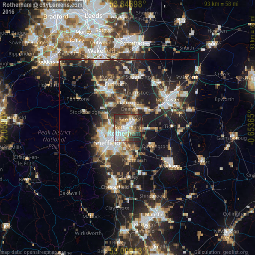
Analysis of Rotherham night lights 2016
Square area 10x10 km:
 16.8%
16.8%90-99
15.48%80-89
8.6%70-79
9.13%60-69
4.76%50-59
7.94%40-49
9.66%30-39
12.83%20-29
13.49%10-19
1.32%0-9
0%Square area 50x50 km:
4.45%90-99
5.12%80-89
2.82%70-79
3.03%60-69
3.16%50-59
3.6%40-49
3.71%30-39
6.02%20-29
12.27%10-19
17.13%0-9
38.69%Clear (daylight) street map image can be seen on geolist.org.
Map coordinates:
53° 50' 49.1" North, 2° 3' 35.6" West
53° 25' 48.4" North, 1° 21' 24.4" West
53° 0' 32.9" North, 0° 39' 13.1" West
Some cities around Rotherham sort by population:
• Sheffield
8.9 km =5.5 mi,  234°
234°
• Burngreave
7.9 km =4.9 mi,  238°
238°
• Chapeltown
8.6 km =5.3 mi,  296°
296°
• Rawmarsh
3.5 km =2.2 mi,  13°
13°
• Wath upon Dearne
8.1 km =5 mi, 5°
• Hoyland Nether
9.9 km =6.2 mi,  321°
321°
• Mexborough
8.3 km =5.2 mi,  30°
30°
• Bolton upon Dearne
10 km =6.2 mi,  15°
15°
2639093 (p: 117,618)
Sources (retrieved 2019-11-25):
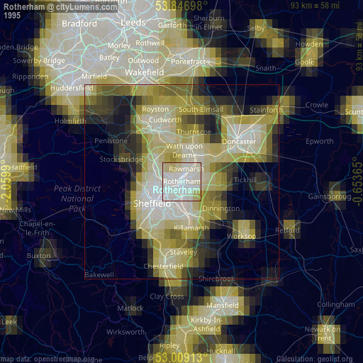
» NASA, Earths city lights 1995
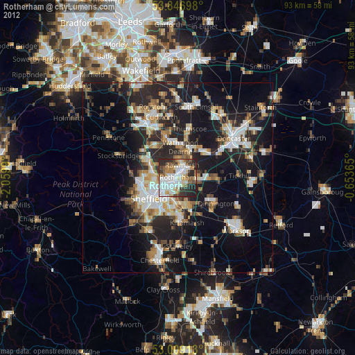
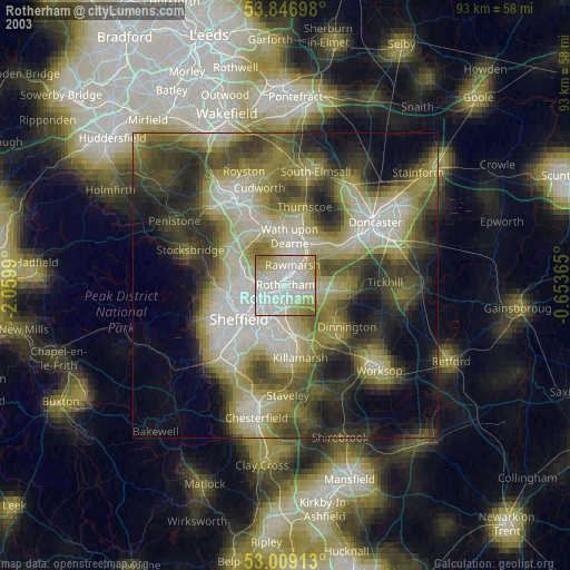
» NASA city lights 2003
» Earth at Night: Flat Maps 2012, 2016