Wath upon Dearne night lights from space
Night Light of Wath upon Dearne (England) from space (United Kingdom) Src. Average luminocity for 10x10km area is 50.2778% and for 50x50km: 33.8047%.
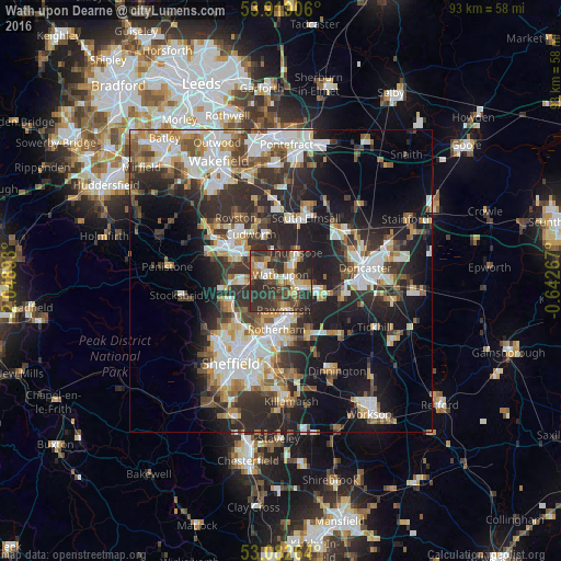
Analysis of Wath upon Dearne night lights 2016
Square area 10x10 km:
 5.56%
5.56%90-99
5.56%80-89
7.94%70-79
8.07%60-69
6.35%50-59
5.82%40-49
11.64%30-39
19.58%20-29
27.78%10-19
1.72%0-9
0%Square area 50x50 km:
6.54%90-99
6.88%80-89
3.24%70-79
3.91%60-69
3.65%50-59
4.39%40-49
4.29%30-39
6.65%20-29
12.15%10-19
14.79%0-9
33.51%Clear (daylight) street map image can be seen on geolist.org.
Map coordinates:
53° 55' 8.6" North, 2° 2' 56.1" West
53° 30' 10.5" North, 1° 20' 44.9" West
53° 4' 57.5" North, 0° 38' 33.6" West
Some cities around Wath upon Dearne sort by population:
• Rotherham
8.1 km =5 mi,  185°
185°
• Rawmarsh
4.7 km =2.9 mi,  178°
178°
• Conisbrough
7.9 km =4.9 mi,  107°
107°
• Hoyland Nether
6.9 km =4.3 mi,  267°
267°
• Wombwell
4 km =2.5 mi,  301°
301°
• Mexborough
3.7 km =2.3 mi, 105°
• Bolton upon Dearne
2.5 km =1.6 mi,  51°
51°
• Darfield
4 km =2.5 mi,  329°
329°
2634672 (p: 17,161)
Sources (retrieved 2019-11-25):
» Earth at Night: Flat Maps 2012, 2016