Abercynon night lights from space
Night Light of Abercynon (Wales) from space (United Kingdom) Src. Average luminocity for 10x10km area is 16.6036% and for 50x50km: 18.5415%.
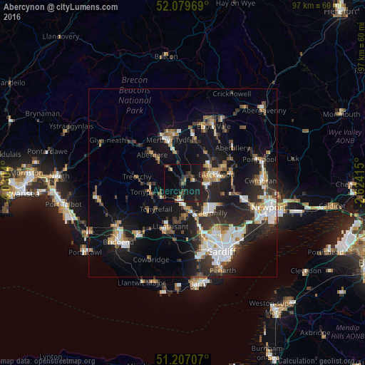
Analysis of Abercynon night lights 2016
Square area 10x10 km:
 0.28%
0.28%90-99
1.26%80-89
1.12%70-79
1.26%60-69
0.56%50-59
1.4%40-49
2.66%30-39
6.44%20-29
5.32%10-19
34.59%0-9
45.1%Square area 50x50 km:
2.88%90-99
3.53%80-89
1.44%70-79
1.98%60-69
1.85%50-59
2%40-49
2.49%30-39
3.06%20-29
6.69%10-19
15.06%0-9
59.02%Clear (daylight) street map image can be seen on geolist.org.
Map coordinates:
52° 4' 46.9" North, 4° 1' 49.4" West
51° 38' 43.7" North, 3° 19' 38.2" West
51° 12' 25.5" North, 2° 37' 26.9" West
Some cities around Abercynon sort by population:
• Pontypridd
4.9 km =3 mi,  191°
191°
• Gelligaer
5.3 km =3.3 mi,  66°
66°
• Bargoed
7.7 km =4.8 mi,  56°
56°
• Nelson
3.1 km =1.9 mi, 73°
• Treharris
2.5 km =1.6 mi,  33°
33°
• Mountain Ash
5.6 km =3.5 mi,  319°
319°
• Abertridwr
6.9 km =4.3 mi,  143°
143°
• Hengoed
6.6 km =4.1 mi,  84°
84°
2657837 (p: 5,983)
Sources (retrieved 2019-11-25):
» Earth at Night: Flat Maps 2012, 2016