Bracknell night lights from space
Night Light of Bracknell (England) from space (United Kingdom) Src. Average luminocity for 10x10km area is 42.4666% and for 50x50km: 31.2702%.
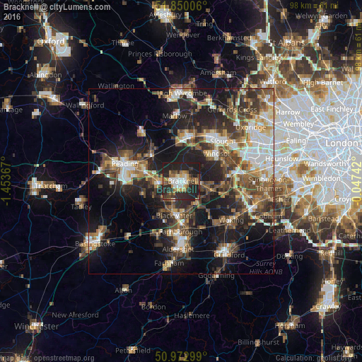
Analysis of Bracknell night lights 2016
Square area 10x10 km:
 6.15%
6.15%90-99
6.28%80-89
2.67%70-79
6.02%60-69
7.75%50-59
4.41%40-49
6.15%30-39
7.49%20-29
28.61%10-19
24.47%0-9
0%Square area 50x50 km:
4.5%90-99
5.24%80-89
2.82%70-79
3.63%60-69
4.36%50-59
5.48%40-49
6.61%30-39
5.89%20-29
10.22%10-19
17.58%0-9
33.69%Clear (daylight) street map image can be seen on geolist.org.
Map coordinates:
51° 51' 0.2" North, 1° 27' 13.2" West
51° 24' 49.1" North, 0° 45' 1.9" West
50° 58' 22.8" North, 0° 2' 50.7" West
Some cities around Bracknell sort by population:
• Wokingham
5.9 km =3.7 mi,  267°
267°
• Camberley
8.5 km =5.3 mi,  176°
176°
• Crowthorne
5.6 km =3.5 mi,  210°
210°
• Yateley
9.6 km =6 mi,  215°
215°
• Ascot
5.3 km =3.3 mi,  93°
93°
• Twyford
10.2 km =6.3 mi,  311°
311°
• Lightwater
9.1 km =5.7 mi,  142°
142°
• Bagshot
7.3 km =4.5 mi, 143°
2655009 (p: 76,103)
Sources (retrieved 2019-11-25):
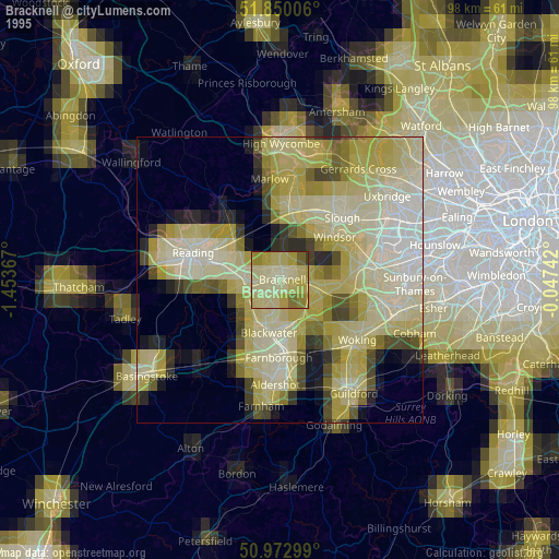
» NASA, Earths city lights 1995
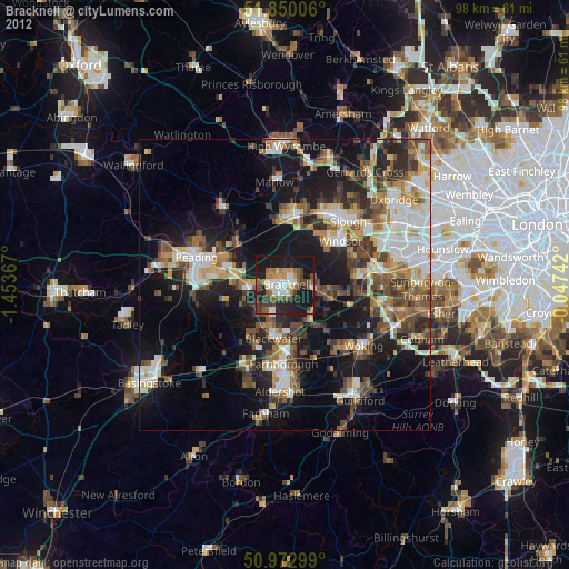
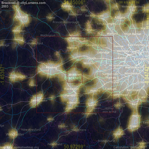
» NASA city lights 2003
» Earth at Night: Flat Maps 2012, 2016