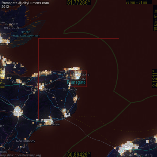
Ramsgate night lights from space
Night Light of Ramsgate (England) from space (United Kingdom) Src. Average luminocity for 10x10km area is 27.6639% and for 50x50km: 4.5841%.
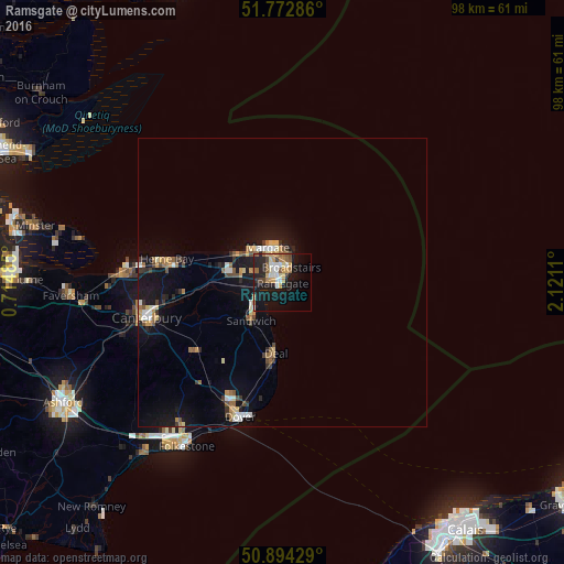
Analysis of Ramsgate night lights 2016
Square area 10x10 km:
 3.22%
3.22%90-99
4.76%80-89
3.64%70-79
5.04%60-69
3.08%50-59
4.06%40-49
2.8%30-39
1.54%20-29
7.56%10-19
27.73%0-9
36.55%Square area 50x50 km:
0.42%90-99
0.64%80-89
0.5%70-79
0.62%60-69
0.65%50-59
0.58%40-49
0.57%30-39
0.56%20-29
0.74%10-19
4.74%0-9
89.98%Clear (daylight) street map image can be seen on geolist.org.
Map coordinates:
51° 46' 22.3" North, 0° 42' 53.5" East
51° 20' 8.4" North, 1° 25' 4.7" East
50° 53' 39.4" North, 2° 7' 16" East
Some cities around Ramsgate sort by population:
• Saint Peters
3.4 km =2.1 mi,  358°
358°
• Margate
5.5 km =3.4 mi,  336°
336°
• Herne Bay
20.5 km =12.7 mi,  281°
281°
• Deal
12.5 km =7.8 mi,  184°
184°
• Broadstairs
3 km =1.9 mi,  29°
29°
• Birchington-on-Sea
9 km =5.6 mi,  299°
299°
• Sturry
21 km =13 mi,  259°
259°
• Westgate on Sea
7.7 km =4.8 mi,  312°
312°
2639660 (p: 38,624)
Sources (retrieved 2019-11-25):
» Earth at Night: Flat Maps 2012, 2016