Deal night lights from space
Night Light of Deal (England) from space (United Kingdom) Src. Average luminocity for 10x10km area is 4.6485% and for 50x50km: 5.9292%.
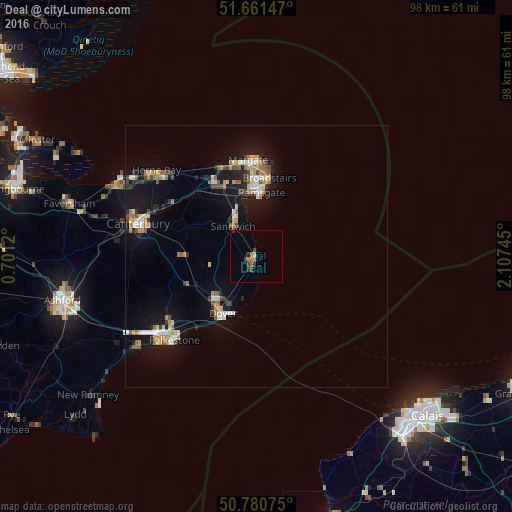

Analysis of Deal night lights 2016
Square area 10x10 km:
 0%
0%90-99
0%80-89
0.56%70-79
0%60-69
0.56%50-59
2.24%40-49
1.26%30-39
1.82%20-29
1.12%10-19
0%0-9
92.44%Square area 50x50 km:
0.58%90-99
0.86%80-89
0.68%70-79
0.83%60-69
0.76%50-59
0.78%40-49
0.64%30-39
0.7%20-29
0.84%10-19
6.11%0-9
87.21%Clear (daylight) street map image can be seen on geolist.org.
Map coordinates:
51° 39' 41.3" North, 0° 42' 4.3" East
51° 13' 23.6" North, 1° 24' 15.6" East
50° 46' 50.7" North, 2° 6' 26.8" East
Some cities around Deal sort by population:
• Saint Peters
16 km =9.9 mi,  3°
3°
• Margate
17.6 km =10.9 mi,  355°
355°
• Dover
12.6 km =7.8 mi,  210°
210°
• Ramsgate
12.5 km =7.8 mi, 4°
• Broadstairs
15.3 km =9.5 mi,  9°
9°
• Birchington-on-Sea
18.3 km =11.4 mi,  337°
337°
• Hawkinge
20.9 km =13 mi,  234°
234°
• Westgate on Sea
18.3 km =11.4 mi,  345°
345°
2651468 (p: 30,555)
Sources (retrieved 2019-11-25):
» Earth at Night: Flat Maps 2012, 2016