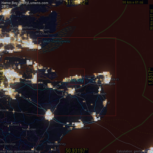
Herne Bay night lights from space
Night Light of Herne Bay (England) from space (United Kingdom) Src. Average luminocity for 10x10km area is 13.0518% and for 50x50km: 6.4473%.
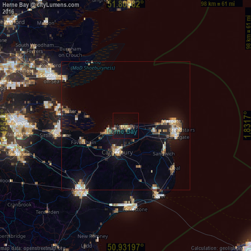
Analysis of Herne Bay night lights 2016
Square area 10x10 km:
 0.42%
0.42%90-99
1.54%80-89
0%70-79
1.96%60-69
3.5%50-59
1.4%40-49
2.52%30-39
3.36%20-29
1.82%10-19
12.75%0-9
70.73%Square area 50x50 km:
0.49%90-99
0.86%80-89
0.63%70-79
0.8%60-69
1.03%50-59
0.75%40-49
0.89%30-39
0.83%20-29
1.28%10-19
6.6%0-9
85.83%Clear (daylight) street map image can be seen on geolist.org.
Map coordinates:
51° 48' 35.4" North, 0° 25' 31.6" East
51° 22' 22.8" North, 1° 7' 42.9" East
50° 55' 55.1" North, 1° 49' 54.1" East
Some cities around Herne Bay sort by population:
• Saint Peters
20 km =12.4 mi,  92°
92°
• Margate
17.9 km =11.1 mi, 87°
• Canterbury
11 km =6.8 mi,  197°
197°
• Whitstable
7.3 km =4.5 mi,  259°
259°
• Faversham
17.9 km =11.1 mi,  248°
248°
• Birchington-on-Sea
12.2 km =7.6 mi, 88°
• Sturry
8 km =5 mi,  183°
183°
• Westgate on Sea
14.5 km =9 mi, 85°
2647057 (p: 36,642)
Sources (retrieved 2019-11-25):
» Earth at Night: Flat Maps 2012, 2016