Pocklington night lights from space
Night Light of Pocklington (England) from space (United Kingdom) Src. Average luminocity for 10x10km area is 2.0595% and for 50x50km: 6.3492%.
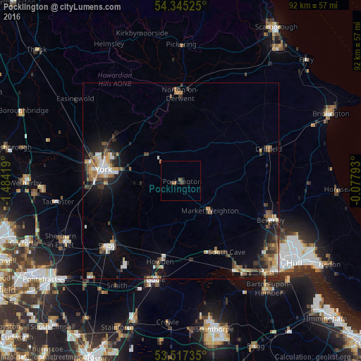
Analysis of Pocklington night lights 2016
Square area 10x10 km:
 0%
0%90-99
0%80-89
0%70-79
0%60-69
1.06%50-59
0.53%40-49
0.93%30-39
0.13%20-29
1.06%10-19
1.06%0-9
95.24%Square area 50x50 km:
0.73%90-99
0.97%80-89
0.51%70-79
0.63%60-69
1.01%50-59
1.03%40-49
1.15%30-39
1.14%20-29
1.56%10-19
4.16%0-9
87.11%Clear (daylight) street map image can be seen on geolist.org.
Map coordinates:
54° 20' 42.9" North, 1° 29' 3.1" West
53° 56' 0.1" North, 0° 46' 51.8" West
53° 31' 2.5" North, 0° 4' 40.5" West
Some cities around Pocklington sort by population:
• York
19.9 km =12.4 mi,  277°
277°
• Haxby
21 km =13 mi,  295°
295°
• Scalby
19 km =11.8 mi,  167°
167°
• Watton
21.7 km =13.5 mi,  90°
90°
• Norton
22.2 km =13.8 mi,  359°
359°
• Market Weighton
10.9 km =6.8 mi,  135°
135°
• Strensall
20.4 km =12.7 mi,  305°
305°
• Malton
22.7 km =14.1 mi, 356°
2640185 (p: 8,337)
Sources (retrieved 2019-11-25):
» Earth at Night: Flat Maps 2012, 2016