Haxby night lights from space
Night Light of Haxby (England) from space (United Kingdom) Src. Average luminocity for 10x10km area is 24.4747% and for 50x50km: 5.393%.
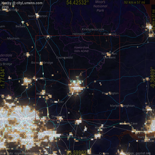
Analysis of Haxby night lights 2016
Square area 10x10 km:
 3.54%
3.54%90-99
3.66%80-89
2.53%70-79
3.16%60-69
2.4%50-59
2.15%40-49
5.56%30-39
2.15%20-29
9.22%10-19
22.85%0-9
42.8%Square area 50x50 km:
0.73%90-99
0.77%80-89
0.44%70-79
0.57%60-69
0.98%50-59
0.59%40-49
0.79%30-39
0.76%20-29
1.41%10-19
3.55%0-9
89.4%Clear (daylight) street map image can be seen on geolist.org.
Map coordinates:
54° 25' 31.2" North, 1° 46' 27.6" West
54° 0' 51.2" North, 1° 4' 16.4" West
53° 35' 56.5" North, 0° 22' 5.1" West
Some cities around Haxby sort by population:
• York
6.3 km =3.9 mi,  186°
186°
• Wetherby
22.7 km =14.1 mi,  245°
245°
• Pocklington
21 km =13 mi,  115°
115°
• Norton
22.9 km =14.2 mi,  54°
54°
• Tadcaster
19.2 km =11.9 mi,  220°
220°
• Boston Spa
21.7 km =13.5 mi,  235°
235°
• Strensall
3.7 km =2.3 mi,  39°
39°
• Malton
22.4 km =13.9 mi, 52°
2647269 (p: 11,894)
Sources (retrieved 2019-11-25):
» Earth at Night: Flat Maps 2012, 2016