Malton night lights from space
Night Light of Malton (England) from space (United Kingdom) Src. Average luminocity for 10x10km area is 3.8851% and for 50x50km: 3.1227%.
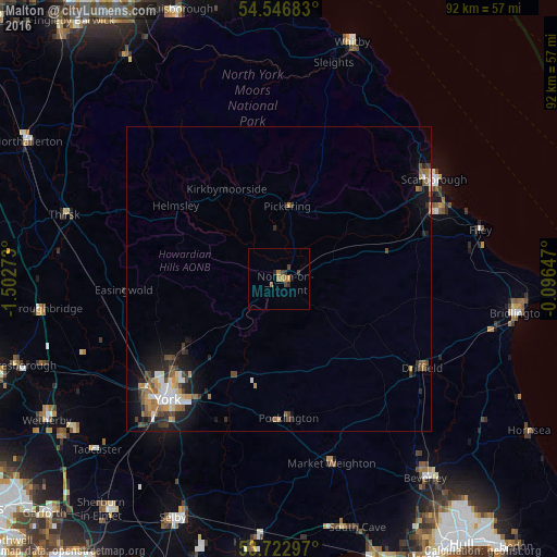
Analysis of Malton night lights 2016
Square area 10x10 km:
 0%
0%90-99
0%80-89
0%70-79
1.01%60-69
1.89%50-59
0.13%40-49
1.14%30-39
1.39%20-29
1.01%10-19
0.38%0-9
93.06%Square area 50x50 km:
0.41%90-99
0.44%80-89
0.21%70-79
0.37%60-69
0.67%50-59
0.38%40-49
0.57%30-39
0.47%20-29
0.91%10-19
2.18%0-9
93.4%Clear (daylight) street map image can be seen on geolist.org.
Map coordinates:
54° 32' 48.6" North, 1° 30' 9.8" West
54° 8' 13" North, 0° 47' 58.6" West
53° 43' 22.7" North, 0° 5' 47.3" West
Some cities around Malton sort by population:
• York
27.2 km =16.9 mi,  222°
222°
• Scarborough
30.2 km =18.8 mi,  58°
58°
• Driffield
27.3 km =17 mi,  122°
122°
• Haxby
22.4 km =13.9 mi,  232°
232°
• Pocklington
22.7 km =14.1 mi,  176°
176°
• Norton
1 km =0.6 mi,  114°
114°
• Pickering
12.8 km =8 mi,  9°
9°
• Strensall
18.8 km =11.7 mi, 234°
2643142 (p: 5,135)
Sources (retrieved 2019-11-25):
» Earth at Night: Flat Maps 2012, 2016