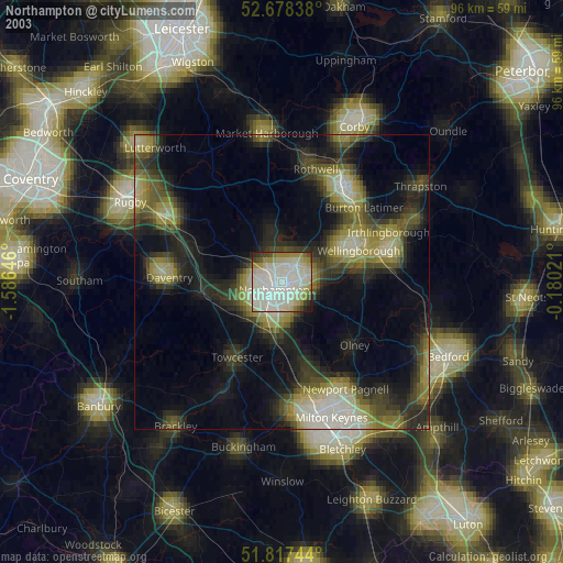
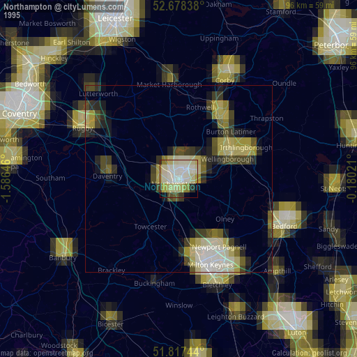
Northampton night lights from space
Night Light of Northampton (England) from space (United Kingdom) Src. Average luminocity for 10x10km area is 58.2976% and for 50x50km: 13.4673%.
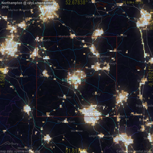
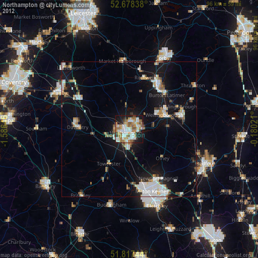
Analysis of Northampton night lights 2016
Square area 10x10 km:
 12.43%
90-99
12.43%80-89
5.42%70-79
5.82%60-69
10.45%50-59
12.7%40-49
11.11%30-39
3.84%20-29
12.04%10-19
13.36%0-9
0.4%Square area 50x50 km:
2.32%90-99
2.39%80-89
1.22%70-79
1.04%60-69
1.37%50-59
1.71%40-49
1.99%30-39
1.38%20-29
3.16%10-19
12.24%0-9
71.18%Clear (daylight) street map image can be seen on geolist.org.
Map coordinates:
52° 40' 42.2" North, 1° 35' 11.3" West
52° 15' 0" North, 0° 52' 60" West
51° 49' 2.8" North, 0° 10' 48.8" West
Some cities around Northampton sort by population:
• Wellingborough
14.1 km =8.8 mi,  65°
65°
• Daventry
18.9 km =11.7 mi,  272°
272°
• Towcester
14.9 km =9.3 mi,  209°
209°
• Hardingstone
4.1 km =2.5 mi,  182°
182°
• Burton Latimer
18.8 km =11.7 mi,  47°
47°
• Olney
16.4 km =10.2 mi,  130°
130°
• Earls Barton
9.1 km =5.7 mi,  78°
78°
• Brixworth
8.9 km =5.5 mi,  351°
351°
2641430 (p: 215,963)
Sources (retrieved 2019-11-25):
» NASA, Earths city lights 1995
» NASA city lights 2003
» Earth at Night: Flat Maps 2012, 2016