Wellingborough night lights from space
Night Light of Wellingborough (England) from space (United Kingdom) Src. Average luminocity for 10x10km area is 28.2917% and for 50x50km: 11.7454%.
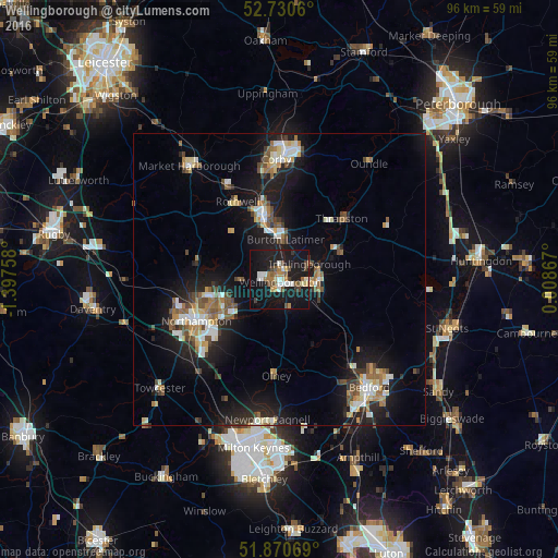
Analysis of Wellingborough night lights 2016
Square area 10x10 km:
 3.91%
3.91%90-99
4.42%80-89
2.4%70-79
2.02%60-69
3.91%50-59
4.42%40-49
3.91%30-39
2.78%20-29
3.28%10-19
48.36%0-9
20.58%Square area 50x50 km:
1.53%90-99
1.81%80-89
1.19%70-79
1.05%60-69
1.53%50-59
1.58%40-49
1.83%30-39
1.29%20-29
3.01%10-19
11.51%0-9
73.67%Clear (daylight) street map image can be seen on geolist.org.
Map coordinates:
52° 43' 50.2" North, 1° 23' 51.3" West
52° 18' 9.8" North, 0° 41' 40.1" West
51° 52' 14.5" North, 0° 0' 31.2" East
Some cities around Wellingborough sort by population:
• Northampton
14.1 km =8.8 mi,  245°
245°
• Kettering
10.8 km =6.7 mi,  348°
348°
• Rushden
6.5 km =4 mi,  103°
103°
• Raunds
11.7 km =7.3 mi,  66°
66°
• Irthlingborough
6.3 km =3.9 mi,  64°
64°
• Burton Latimer
6.9 km =4.3 mi,  9°
9°
• Higham Ferrers
6.9 km =4.3 mi,  87°
87°
• Earls Barton
5.7 km =3.5 mi,  224°
224°
2634578 (p: 50,577)
Sources (retrieved 2019-11-25):
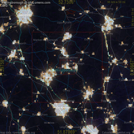
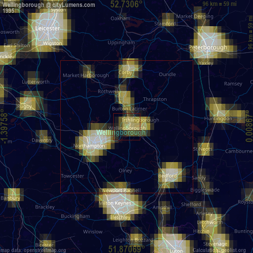
» NASA, Earths city lights 1995
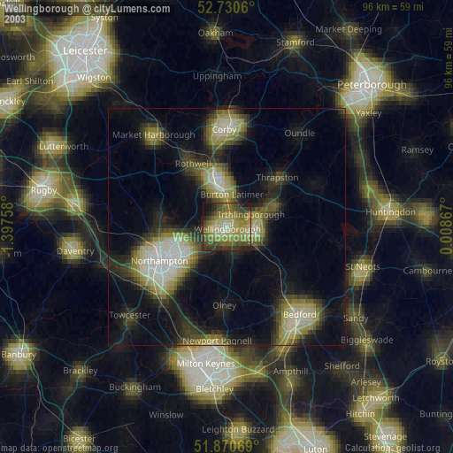
» NASA city lights 2003
» Earth at Night: Flat Maps 2012, 2016