Newhaven night lights from space
Night Light of Newhaven (England) from space (United Kingdom) Src. Average luminocity for 10x10km area is 0.1048% and for 50x50km: 9.6202%.
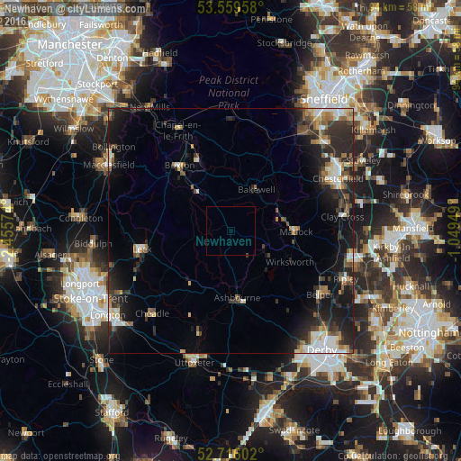
Analysis of Newhaven night lights 2016
Square area 10x10 km:
 0%
0%90-99
0%80-89
0%70-79
0%60-69
0%50-59
0%40-49
0.25%30-39
0%20-29
0%10-19
0%0-9
99.75%Square area 50x50 km:
1.34%90-99
1.45%80-89
1.01%70-79
0.75%60-69
1.2%50-59
1.35%40-49
1.38%30-39
1.86%20-29
4.12%10-19
6.91%0-9
78.62%Clear (daylight) street map image can be seen on geolist.org.
Map coordinates:
53° 33' 34.5" North, 2° 27' 20.7" West
53° 8' 23.5" North, 1° 45' 9.4" West
52° 42' 57.7" North, 1° 2' 58.2" West
Some cities around Newhaven sort by population:
• Belper
22.3 km =13.9 mi,  125°
125°
• Buxton
16.7 km =10.4 mi,  321°
321°
• Leek
18.4 km =11.4 mi,  257°
257°
• Matlock
13.1 km =8.1 mi,  90°
90°
• Ashbourne
13.8 km =8.6 mi,  174°
174°
• Chapel en le Frith
23.1 km =14.4 mi,  332°
332°
• Wingerworth
22.4 km =13.9 mi,  72°
72°
• Wirksworth
13.5 km =8.4 mi,  118°
118°
11863037 (p: 13,222)
Sources (retrieved 2019-11-25):
» Earth at Night: Flat Maps 2012, 2016