Nairn night lights from space
Night Light of Nairn (Scotland) from space (United Kingdom) Src. Average luminocity for 10x10km area is 2.4071% and for 50x50km: 2.4362%.
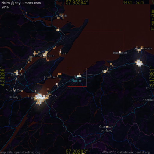
Analysis of Nairn night lights 2016
Square area 10x10 km:
 0.36%
0.36%90-99
1.55%80-89
0%70-79
0%60-69
0%50-59
0%40-49
0%30-39
0.48%20-29
0%10-19
0.48%0-9
97.14%Square area 50x50 km:
0.35%90-99
0.4%80-89
0.23%70-79
0.18%60-69
0.38%50-59
0.35%40-49
0.32%30-39
0.28%20-29
0.54%10-19
1.68%0-9
95.29%Clear (daylight) street map image can be seen on geolist.org.
Map coordinates:
57° 57' 21.4" North, 4° 34' 58.3" West
57° 34' 51.4" North, 3° 52' 47" West
57° 12' 7.3" North, 3° 10' 35.8" West
Some cities around Nairn sort by population:
• Inverness
23.5 km =14.6 mi,  241°
241°
• Elgin
34.3 km =21.3 mi,  77°
77°
• Forres
15.7 km =9.8 mi, 78°
• Buckie
55.6 km =34.5 mi, 79°
• Lossiemouth
38.8 km =24.1 mi,  66°
66°
• Alness
25.7 km =16 mi,  299°
299°
• Dingwall
32.7 km =20.3 mi,  272°
272°
• Westhill
20 km =12.4 mi,  233°
233°
2641910 (p: 9,860)
Sources (retrieved 2019-11-25):
» Earth at Night: Flat Maps 2012, 2016