Ossett night lights from space
Night Light of Ossett (England) from space (United Kingdom) Src. Average luminocity for 10x10km area is 74.4444% and for 50x50km: 41.722%.
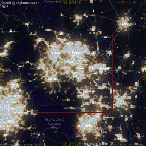
Analysis of Ossett night lights 2016
Square area 10x10 km:
 24.62%
90-99
21.34%80-89
4.29%70-79
10.48%60-69
7.95%50-59
10.1%40-49
6.31%30-39
6.69%20-29
7.07%10-19
1.14%0-9
0%Square area 50x50 km:
10.38%90-99
9.18%80-89
3.7%70-79
4.4%60-69
4.79%50-59
5.12%40-49
4.96%30-39
7.37%20-29
11.73%10-19
13.06%0-9
25.32%Clear (daylight) street map image can be seen on geolist.org.
Map coordinates:
54° 5' 39" North, 2° 16' 59.5" West
53° 40' 47.2" North, 1° 34' 48.2" West
53° 15' 40.5" North, 0° 52' 37" West
Some cities around Ossett sort by population:
• Wakefield
5.4 km =3.4 mi,  85°
85°
• Morley
6.8 km =4.2 mi,  349°
349°
• Dewsbury
3.5 km =2.2 mi,  290°
290°
• Batley
4.4 km =2.7 mi,  306°
306°
• Lofthouse
7.8 km =4.8 mi,  44°
44°
• Mirfield
7.7 km =4.8 mi,  264°
264°
• Heckmondwike
7.1 km =4.4 mi, 294°
• Horbury
2.5 km =1.6 mi,  148°
148°
2640869 (p: 21,616)
Sources (retrieved 2019-11-25):
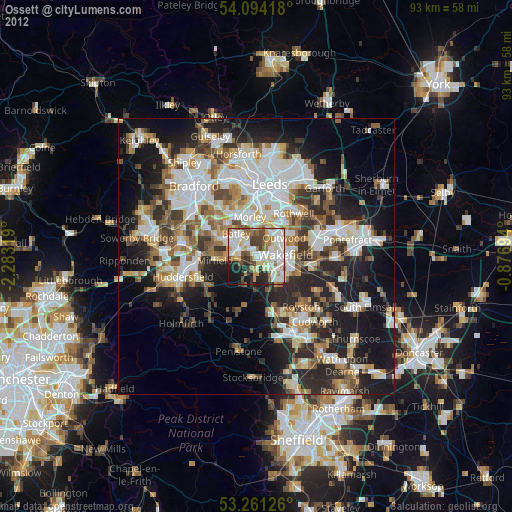
» Earth at Night: Flat Maps 2012, 2016