Meltham night lights from space
Night Light of Meltham (England) from space (United Kingdom) Src. Average luminocity for 10x10km area is 18.8801% and for 50x50km: 37.4816%.
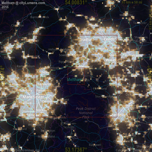
Analysis of Meltham night lights 2016
Square area 10x10 km:
 0.63%
0.63%90-99
1.14%80-89
2.15%70-79
3.16%60-69
3.28%50-59
4.42%40-49
2.53%30-39
3.91%20-29
9.34%10-19
16.41%0-9
53.03%Square area 50x50 km:
11.63%90-99
9.24%80-89
3.28%70-79
3.86%60-69
4.31%50-59
4.25%40-49
3.42%30-39
3.98%20-29
5.62%10-19
8.17%0-9
42.25%Clear (daylight) street map image can be seen on geolist.org.
Map coordinates:
54° 0' 29.9" North, 2° 33' 6.3" West
53° 35' 35" North, 1° 50' 55" West
53° 10' 25.2" North, 1° 8' 43.8" West
Some cities around Meltham sort by population:
• Huddersfield
7.5 km =4.7 mi,  34°
34°
• Brighouse
13 km =8.1 mi,  19°
19°
• Mirfield
13.4 km =8.3 mi,  48°
48°
• Elland
10.3 km =6.4 mi,  3°
3°
• Rastrick
11.7 km =7.3 mi, 19°
• Sowerby Bridge
13.5 km =8.4 mi,  342°
342°
• Shepley
8.8 km =5.5 mi,  97°
97°
• Shelley
10.9 km =6.8 mi,  85°
85°
2642766 (p: 7,836)
Sources (retrieved 2019-11-25):
» Earth at Night: Flat Maps 2012, 2016