Horbury night lights from space
Night Light of Horbury (England) from space (United Kingdom) Src. Average luminocity for 10x10km area is 65.7917% and for 50x50km: 42.2514%.
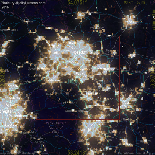
Analysis of Horbury night lights 2016
Square area 10x10 km:
 22.85%
90-99
18.31%80-89
3.03%70-79
5.56%60-69
5.05%50-59
8.59%40-49
5.93%30-39
11.87%20-29
12.75%10-19
5.43%0-9
0.63%Square area 50x50 km:
10.6%90-99
9.41%80-89
3.76%70-79
4.59%60-69
4.75%50-59
5.17%40-49
5.33%30-39
7.31%20-29
11.72%10-19
11.79%0-9
25.59%Clear (daylight) street map image can be seen on geolist.org.
Map coordinates:
54° 4' 30.4" North, 2° 15' 47.7" West
53° 39' 37.8" North, 1° 33' 36.5" West
53° 14' 30.5" North, 0° 51' 25.2" West
Some cities around Horbury sort by population:
• Wakefield
4.8 km =3 mi,  58°
58°
• Dewsbury
5.7 km =3.5 mi,  306°
306°
• Batley
6.8 km =4.2 mi, 314°
• Lofthouse
8.7 km =5.4 mi,  28°
28°
• Ossett
2.5 km =1.6 mi,  328°
328°
• Darton
8.5 km =5.3 mi,  164°
164°
• Clayton West
8 km =5 mi,  204°
204°
• Crofton
8.6 km =5.3 mi,  93°
93°
2646613 (p: 10,225)
Sources (retrieved 2019-11-25):
» Earth at Night: Flat Maps 2012, 2016