Llanelli night lights from space
Night Light of Llanelli (Wales) from space (United Kingdom) Src. Average luminocity for 10x10km area is 17.9958% and for 50x50km: 6.2097%.
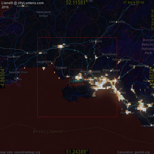
Analysis of Llanelli night lights 2016
Square area 10x10 km:
 2.52%
2.52%90-99
1.96%80-89
0.56%70-79
4.34%60-69
1.82%50-59
0.98%40-49
2.94%30-39
2.66%20-29
5.46%10-19
17.51%0-9
59.24%Square area 50x50 km:
0.77%90-99
1.06%80-89
0.45%70-79
0.78%60-69
0.9%50-59
0.81%40-49
0.84%30-39
0.93%20-29
2.34%10-19
4.65%0-9
86.48%Clear (daylight) street map image can be seen on geolist.org.
Map coordinates:
52° 6' 56.9" North, 4° 51' 54.1" West
51° 40' 55" North, 4° 9' 42.9" West
51° 14' 38" North, 3° 27' 31.6" West
Some cities around Llanelli sort by population:
• Swansea
16.5 km =10.3 mi,  114°
114°
• Ammanford
17.2 km =10.7 mi,  44°
44°
• Gorseinon
8.4 km =5.2 mi,  99°
99°
• Clydach
18.1 km =11.2 mi,  89°
89°
• Carmarthen
21.7 km =13.5 mi,  332°
332°
• Pontarddulais
9.2 km =5.7 mi,  67°
67°
• Burry Port
5.9 km =3.7 mi,  272°
272°
• Brynamman
24.2 km =15 mi,  57°
57°
2644100 (p: 49,591)
Sources (retrieved 2019-11-25):
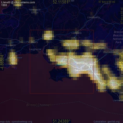
» NASA, Earths city lights 1995
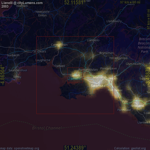
» NASA city lights 2003
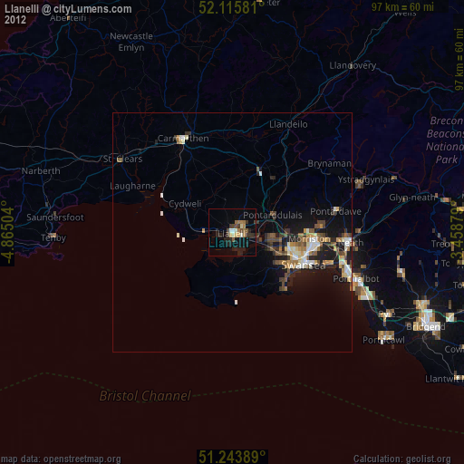
» Earth at Night: Flat Maps 2012, 2016