Livingston night lights from space
Night Light of Livingston (Scotland) from space (United Kingdom) Src. Average luminocity for 10x10km area is 56.5852% and for 50x50km: 21.1602%.
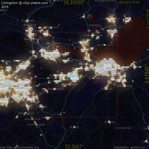
Analysis of Livingston night lights 2016
Square area 10x10 km:
 18.17%
90-99
16.79%80-89
4.89%70-79
1.5%60-69
1.88%50-59
3.88%40-49
4.89%30-39
5.64%20-29
31.58%10-19
10.03%0-9
0.75%Square area 50x50 km:
4.39%90-99
4.74%80-89
1.65%70-79
1.7%60-69
1.92%50-59
1.77%40-49
1.87%30-39
2.38%20-29
8.82%10-19
17.34%0-9
53.42%Clear (daylight) street map image can be seen on geolist.org.
Map coordinates:
56° 17' 42.2" North, 4° 13' 32.6" West
55° 54' 10.4" North, 3° 31' 21.4" West
55° 30' 24.1" North, 2° 49' 10.1" West
Some cities around Livingston sort by population:
• Bathgate
7.6 km =4.7 mi,  269°
269°
• Broxburn
4.7 km =2.9 mi,  42°
42°
• Linlithgow
9.6 km =6 mi,  328°
328°
• Armadale
11.3 km =7 mi,  258°
258°
• Whitburn
10.8 km =6.7 mi,  248°
248°
• Queensferry
12.5 km =7.8 mi, 38°
• Balerno
11.6 km =7.2 mi,  100°
100°
• Blackburn
8 km =5 mi,  239°
239°
2644204 (p: 56,570)
Sources (retrieved 2019-11-25):
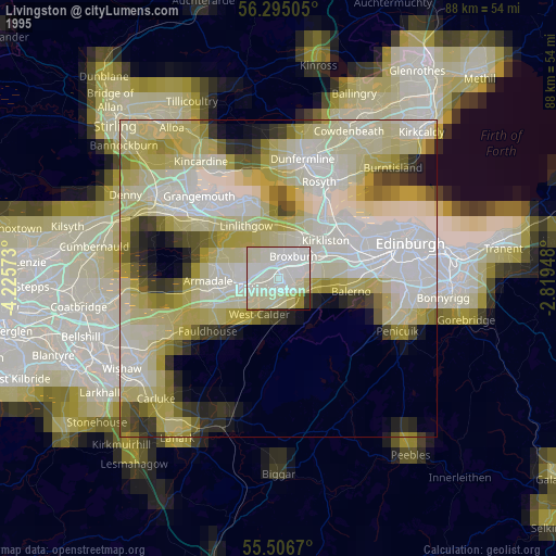
» NASA, Earths city lights 1995
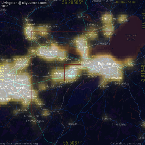
» NASA city lights 2003
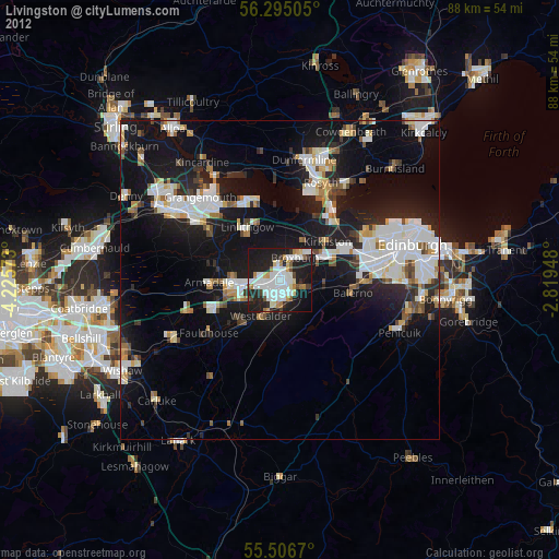
» Earth at Night: Flat Maps 2012, 2016