Armadale night lights from space
Night Light of Armadale (Scotland) from space (United Kingdom) Src. Average luminocity for 10x10km area is 31.3571% and for 50x50km: 23.2752%.
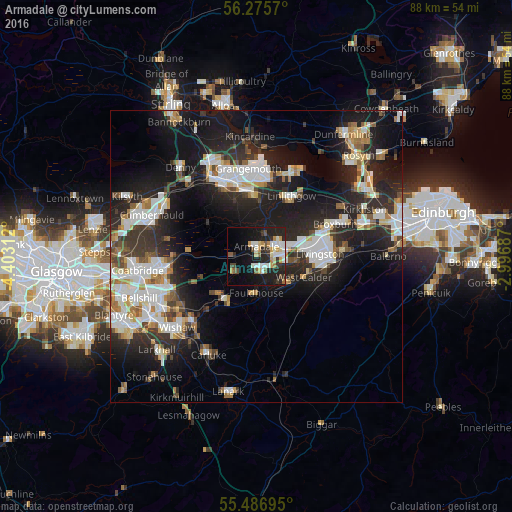
Analysis of Armadale night lights 2016
Square area 10x10 km:
 5.89%
5.89%90-99
5.64%80-89
2.63%70-79
5.64%60-69
1.5%50-59
3.63%40-49
3.13%30-39
4.01%20-29
13.03%10-19
23.43%0-9
31.45%Square area 50x50 km:
4.7%90-99
5.08%80-89
1.63%70-79
2.37%60-69
2.39%50-59
2.14%40-49
2.3%30-39
3.28%20-29
9.24%10-19
17.34%0-9
49.54%Clear (daylight) street map image can be seen on geolist.org.
Map coordinates:
56° 16' 32.5" North, 4° 24' 11.2" West
55° 52' 60" North, 3° 42' 0" West
55° 29' 13" North, 2° 59' 48.7" West
Some cities around Armadale sort by population:
• Livingston
11.3 km =7 mi,  78°
78°
• Falkirk
14.2 km =8.8 mi,  338°
338°
• Bathgate
4.1 km =2.5 mi,  59°
59°
• Linlithgow
12 km =7.5 mi,  30°
30°
• Whitburn
2.1 km =1.3 mi,  150°
150°
• Shotts
9.3 km =5.8 mi,  220°
220°
• Blackburn
4.6 km =2.9 mi,  114°
114°
• Polmont
11.9 km =7.4 mi,  357°
357°
2657067 (p: 11,770)
Sources (retrieved 2019-11-25):
» Earth at Night: Flat Maps 2012, 2016