Leicester night lights from space
Night Light of Leicester (England) from space (United Kingdom) Src. Average luminocity for 10x10km area is 81.4299% and for 50x50km: 16.7955%.
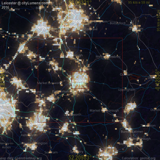
Analysis of Leicester night lights 2016
Square area 10x10 km:
 20.5%
20.5%90-99
26.98%80-89
16.67%70-79
12.04%60-69
7.8%50-59
5.56%40-49
3.57%30-39
2.25%20-29
4.37%10-19
0.26%0-9
0%Square area 50x50 km:
2.48%90-99
3.12%80-89
1.73%70-79
1.44%60-69
1.99%50-59
2.19%40-49
1.97%30-39
2.21%20-29
5.17%10-19
15.17%0-9
62.52%Clear (daylight) street map image can be seen on geolist.org.
Map coordinates:
53° 3' 47.6" North, 1° 50' 5.3" West
52° 38' 19" North, 1° 7' 54.1" West
52° 12' 35.4" North, 0° 25' 42.8" West
Some cities around Leicester sort by population:
• Wigston Magna
6.9 km =4.3 mi,  157°
157°
• Oadby
4.9 km =3 mi,  137°
137°
• Syston
6.6 km =4.1 mi,  41°
41°
• Glenfield
4.4 km =2.7 mi,  281°
281°
• Kirby Muxloe
6.5 km =4 mi,  261°
261°
• Enderby
7.6 km =4.7 mi,  221°
221°
• Anstey
5.5 km =3.4 mi,  315°
315°
• Blaby
7.3 km =4.5 mi,  197°
197°
2644668 (p: 508,916)
Sources (retrieved 2019-11-25):
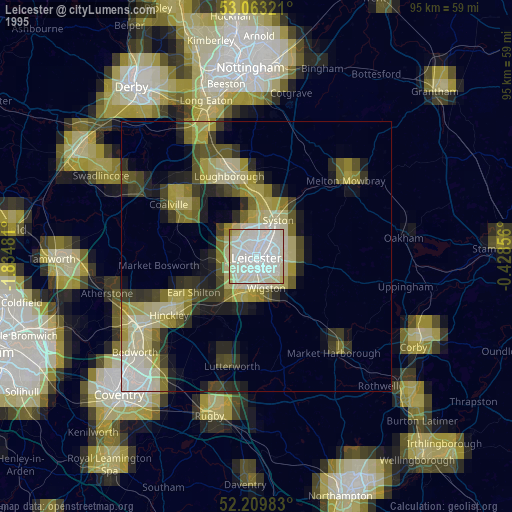
» NASA, Earths city lights 1995
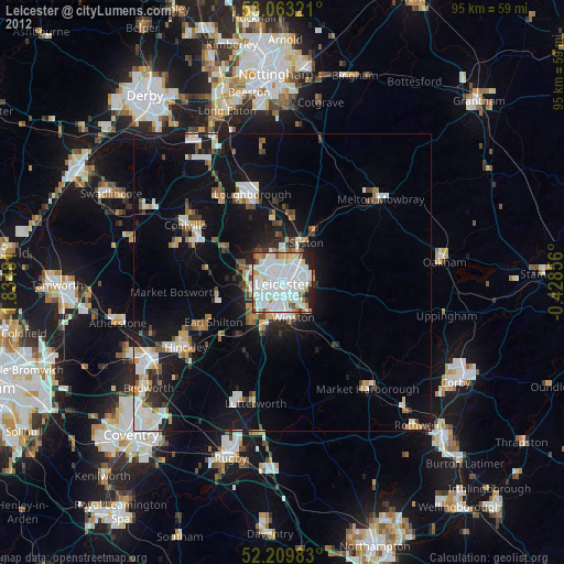
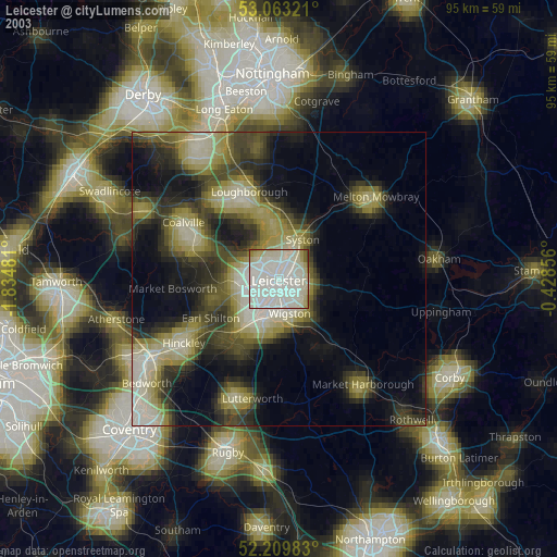
» NASA city lights 2003
» Earth at Night: Flat Maps 2012, 2016