Larne night lights from space
Night Light of Larne (Northern Ireland) from space (United Kingdom) Src. Average luminocity for 10x10km area is 11.3744% and for 50x50km: 6.0171%.
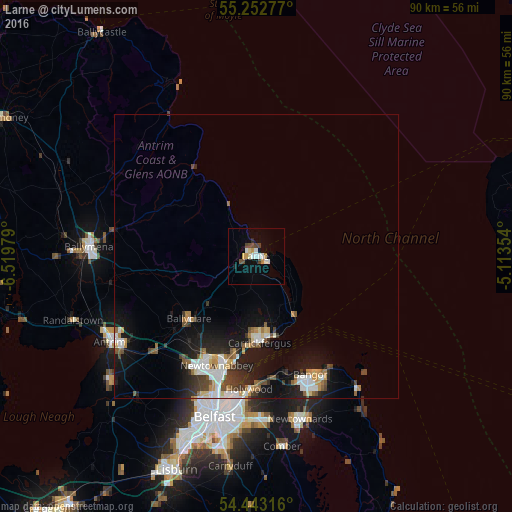
Analysis of Larne night lights 2016
Square area 10x10 km:
 2.03%
2.03%90-99
2.15%80-89
0.72%70-79
1.79%60-69
0.48%50-59
0.72%40-49
3.11%30-39
0%20-29
0.84%10-19
1.79%0-9
86.36%Square area 50x50 km:
1.05%90-99
1.14%80-89
0.43%70-79
0.69%60-69
0.53%50-59
0.71%40-49
0.88%30-39
0.82%20-29
1.47%10-19
4.68%0-9
87.6%Clear (daylight) street map image can be seen on geolist.org.
Map coordinates:
55° 15' 10" North, 6° 31' 11.2" West
54° 51' 0" North, 5° 49' 0" West
54° 26' 35.4" North, 5° 6' 48.7" West
Some cities around Larne sort by population:
• Newtownabbey
22 km =13.7 mi,  195°
195°
• Bangor
23.8 km =14.8 mi,  156°
156°
• Carrickfergus
14.9 km =9.3 mi,  177°
177°
• Dundonald
28.7 km =17.8 mi, 177°
• Holywood
23.5 km =14.6 mi, 181°
• Ballyclare
16.1 km =10 mi,  226°
226°
• Jordanstown
19.3 km =12 mi, 196°
• Greenisland
17 km =10.6 mi,  192°
192°
2644849 (p: 18,421)
Sources (retrieved 2019-11-25):
» Earth at Night: Flat Maps 2012, 2016