Torquay night lights from space
Night Light of Torquay (England) from space (United Kingdom) Src. Average luminocity for 10x10km area is 23.3613% and for 50x50km: 2.8018%.
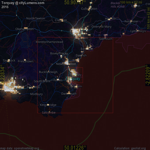

Analysis of Torquay night lights 2016
Square area 10x10 km:
 2.8%
2.8%90-99
2.24%80-89
1.96%70-79
2.94%60-69
2.66%50-59
6.16%40-49
6.72%30-39
2.8%20-29
1.12%10-19
28.85%0-9
41.74%Square area 50x50 km:
0.21%90-99
0.3%80-89
0.2%70-79
0.23%60-69
0.36%50-59
0.59%40-49
0.64%30-39
0.42%20-29
0.36%10-19
2.77%0-9
93.94%Clear (daylight) street map image can be seen on geolist.org.
Map coordinates:
50° 54' 26.9" North, 4° 13' 42" West
50° 27' 43.1" North, 3° 31' 30.8" West
50° 0' 44.1" North, 2° 49' 19.5" West
Some cities around Torquay sort by population:
• Paignton
4.2 km =2.6 mi,  225°
225°
• Newton Abbot
9.6 km =6 mi,  320°
320°
• Teignmouth
9.7 km =6 mi,  12°
12°
• Brixham
7.6 km =4.7 mi,  174°
174°
• Kingsteignton
10.6 km =6.6 mi,  337°
337°
• Cockington
2.2 km =1.4 mi,  273°
273°
• Totnes
11.8 km =7.3 mi,  253°
253°
• Dartmouth
12.8 km =8 mi,  197°
197°
2635650 (p: 65,388)
Sources (retrieved 2019-11-25):
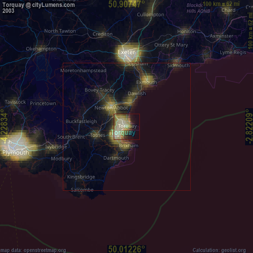
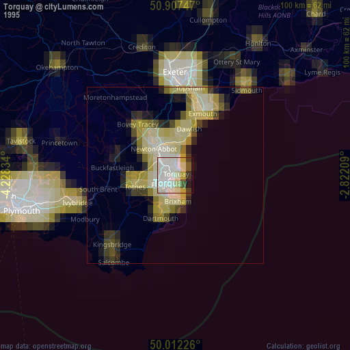
» NASA, Earths city lights 1995
» NASA city lights 2003
» Earth at Night: Flat Maps 2012, 2016