Totnes night lights from space
Night Light of Totnes (England) from space (United Kingdom) Src. Average luminocity for 10x10km area is 2.1583% and for 50x50km: 2.943%.
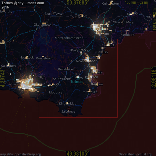
Analysis of Totnes night lights 2016
Square area 10x10 km:
 0.42%
0.42%90-99
0.14%80-89
0%70-79
0.56%60-69
0%50-59
0%40-49
0.28%30-39
0.84%20-29
0%10-19
0.56%0-9
97.2%Square area 50x50 km:
0.21%90-99
0.37%80-89
0.24%70-79
0.27%60-69
0.38%50-59
0.64%40-49
0.63%30-39
0.43%20-29
0.38%10-19
2.34%0-9
94.1%Clear (daylight) street map image can be seen on geolist.org.
Map coordinates:
50° 52' 36.7" North, 4° 23' 14.7" West
50° 25' 51.9" North, 3° 41' 3.5" West
49° 58' 51.8" North, 2° 58' 52.2" West
Some cities around Totnes sort by population:
• Torquay
11.8 km =7.3 mi,  73°
73°
• Paignton
8.3 km =5.2 mi,  86°
86°
• Newton Abbot
12 km =7.5 mi,  25°
25°
• Brixham
12.6 km =7.8 mi,  108°
108°
• Ivybridge
17.2 km =10.7 mi,  254°
254°
• Kingsteignton
15 km =9.3 mi, 28°
• Cockington
9.7 km =6 mi, 68°
• Dartmouth
11.5 km =7.1 mi,  139°
139°
2635610 (p: 8,076)
Sources (retrieved 2019-11-25):
» Earth at Night: Flat Maps 2012, 2016