Hoylake night lights from space
Night Light of Hoylake (England) from space (United Kingdom) Src. Average luminocity for 10x10km area is 20.2063% and for 50x50km: 24.1961%.
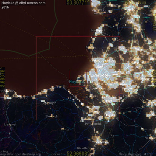
Analysis of Hoylake night lights 2016
Square area 10x10 km:
 1.19%
1.19%90-99
4.1%80-89
2.38%70-79
0.66%60-69
2.78%50-59
4.23%40-49
4.1%30-39
3.7%20-29
8.99%10-19
14.55%0-9
53.31%Square area 50x50 km:
7%90-99
5.51%80-89
1.92%70-79
1.76%60-69
2.2%50-59
1.86%40-49
2.88%30-39
4.45%20-29
6.88%10-19
9.12%0-9
56.43%Clear (daylight) street map image can be seen on geolist.org.
Map coordinates:
53° 48' 27.8" North, 3° 53' 1.6" West
53° 23' 25.7" North, 3° 10' 50.4" West
52° 58' 8.7" North, 2° 28' 39.1" West
Some cities around Hoylake sort by population:
• Birkenhead
11 km =6.8 mi,  88°
88°
• Wallasey
8.5 km =5.3 mi,  64°
64°
• Heswall
9 km =5.6 mi,  141°
141°
• Moreton
4.4 km =2.7 mi,  75°
75°
• Bebington
11.8 km =7.3 mi,  112°
112°
• Prenton
8.7 km =5.4 mi, 106°
• Greasby
4.3 km =2.7 mi,  117°
117°
• West Kirby
2 km =1.2 mi,  186°
186°
2646472 (p: 5,710)
Sources (retrieved 2019-11-25):
» Earth at Night: Flat Maps 2012, 2016