Birkenhead night lights from space
Night Light of Birkenhead (England) from space (United Kingdom) Src. Average luminocity for 10x10km area is 86.8122% and for 50x50km: 33.0685%.
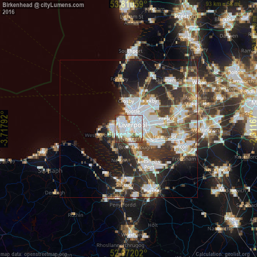
Analysis of Birkenhead night lights 2016
Square area 10x10 km:
 44.58%
90-99
24.74%80-89
7.94%70-79
3.17%60-69
1.85%50-59
4.1%40-49
8.2%30-39
5.29%20-29
0.13%10-19
0%0-9
0%Square area 50x50 km:
8.92%90-99
7.68%80-89
2.96%70-79
2.68%60-69
3.18%50-59
3.14%40-49
4.7%30-39
6.05%20-29
8.98%10-19
10.36%0-9
41.33%Clear (daylight) street map image can be seen on geolist.org.
Map coordinates:
53° 48' 38.1" North, 3° 43' 4.5" West
53° 23' 36.1" North, 3° 0' 53.2" West
52° 58' 19.3" North, 2° 18' 42" West
Some cities around Birkenhead sort by population:
• Liverpool
3.1 km =1.9 mi,  51°
51°
• Wallasey
4.7 km =2.9 mi,  314°
314°
• Moreton
6.8 km =4.2 mi,  276°
276°
• Bebington
4.8 km =3 mi,  181°
181°
• Bromborough
5.5 km =3.4 mi,  154°
154°
• Prenton
3.9 km =2.4 mi,  222°
222°
• Greasby
7.5 km =4.7 mi,  252°
252°
• New Ferry
3.9 km =2.4 mi,  159°
159°
2655613 (p: 325,264)
Sources (retrieved 2019-11-25):
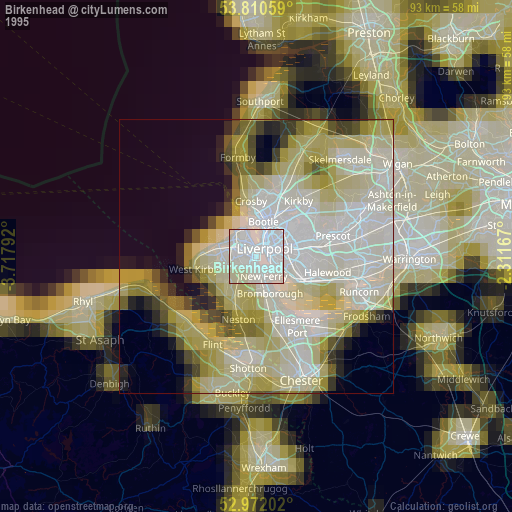
» NASA, Earths city lights 1995
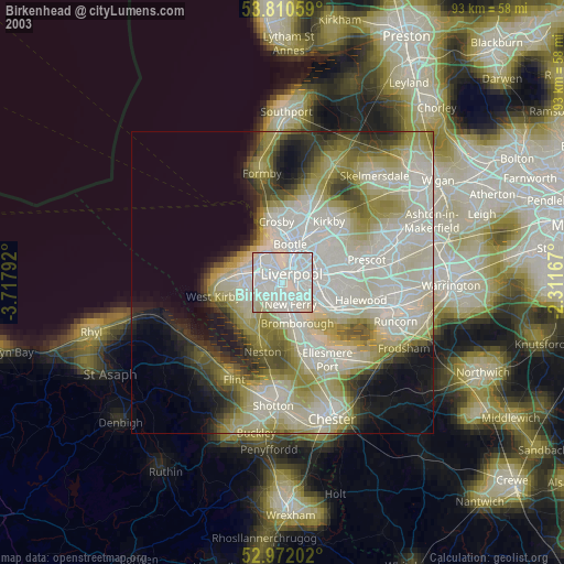
» NASA city lights 2003
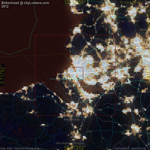
» Earth at Night: Flat Maps 2012, 2016