Strood night lights from space
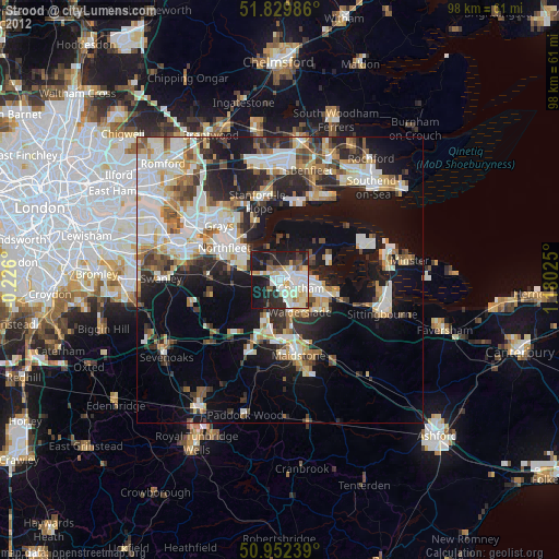
Night Light of Strood (England) from space (United Kingdom) Src. Average luminocity for 10x10km area is 53.7059% and for 50x50km: 31.3725%.
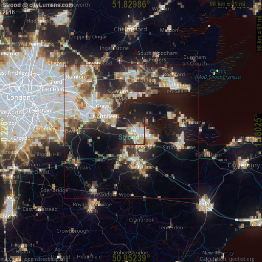
Analysis of Strood night lights 2016
Square area 10x10 km:
 10.22%
90-99
14.29%80-89
9.24%70-79
6.58%60-69
3.92%50-59
3.78%40-49
3.08%30-39
8.12%20-29
22.69%10-19
18.07%0-9
0%Square area 50x50 km:
5.34%90-99
6.55%80-89
3.6%70-79
3.84%60-69
3.88%50-59
3.9%40-49
3.95%30-39
5.26%20-29
9.05%10-19
16.77%0-9
37.87%Clear (daylight) street map image can be seen on geolist.org.
Map coordinates:
51° 49' 47.5" North, 0° 13' 33.6" West
51° 23' 35.6" North, 0° 28' 37.7" East
50° 57' 8.6" North, 1° 10' 48.9" East
Some cities around Strood sort by population:
• Gillingham
5 km =3.1 mi,  95°
95°
• Chatham
3.9 km =2.4 mi,  114°
114°
• Gravesend
9.1 km =5.7 mi,  306°
306°
• Rochester
2.1 km =1.3 mi, 107°
• Snodland
7.4 km =4.6 mi,  198°
198°
• Larkfield
10.4 km =6.5 mi,  191°
191°
• Rainham
9.7 km =6 mi, 110°
• Hoo
6.7 km =4.2 mi,  63°
63°
2636619 (p: 33,381)
Sources (retrieved 2019-11-25):
» Earth at Night: Flat Maps 2012, 2016